Le National, Montreal
Map
Facts and practical information
The Montreal Nationals were an amateur, later professional, and then amateur again men's senior-level ice hockey team. They are notable in that they were the first team to represent French Canada and were the first ice hockey team composed of francophone players. In 1910 during the first season of the National Hockey Association, they were offered a chance to replace the brand new Montreal Canadiens being as they were the established French Canadian club, but would refuse and return to their amateur roots playing in various amateur senior leagues. ()
Address
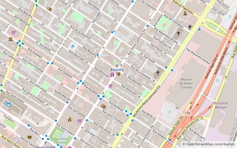
1220 rue Sainte-Catherine EstVille-Marie District (Sainte-Marie)Montreal H2L 3G6
Contact
(514) 845-2014
Social media
Add
Getting there by public transportation
Public transportation stops near this location
- Metro
- Bus
- Train
 Metro
Metro
- Calculate routeBeaudry 2 min walk
- Calculate routeBerri-UQAM 9 min walk
- Calculate routePapineau 11 min walk
- Calculate routeChamp-de-Mars 15 min walk
- Calculate routeDe Maisonneuve / Beaudry 3 min walk
- Calculate routeAtateken / Sainte-Catherine 3 min walk
- Calculate routeSainte-Catherine / Atateken 3 min walk
- Calculate routeFort Edmonton 26 min walk
- Calculate routeVillage 28 min walk
Maps Metro
Metro
MetroDay trips


Frequently Asked Questions (FAQ)
Which popular attractions are close to Le National?
Nearby attractions include Church of Saint-Pierre-Apôtre, Montreal (4 min walk), Radio-Canada, Montreal (7 min walk), Saint Hubert Street, Montreal (7 min walk), Berri Street, Montreal (9 min walk).
How to get to Le National by public transport?
The nearest stations to Le National:
Metro
Bus
Train
Metro
- Beaudry • Lines: 1 (2 min walk)
- Berri-UQAM • Lines: 1, 2, 4 (9 min walk)
Bus
- De Maisonneuve / Beaudry • Lines: 15-O (3 min walk)
- Atateken / Sainte-Catherine • Lines: 14-N, 14-S (3 min walk)
Train
- Fort Edmonton (26 min walk)
- Village (28 min walk)