Tuktut Nogait National Park


Facts and practical information
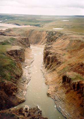
Tuktut Nogait National Park is a national park located in the Northwest Territories of Canada that was established in 1998. Meaning "young caribou" in Inuvialuktun, the park is home to the calving grounds of the Bluenose-West caribou herd. ()
Northwest Territories
Best Ways to Experience the Park
Wildlife
AnimalsSee what popular animal species you can meet in this location.
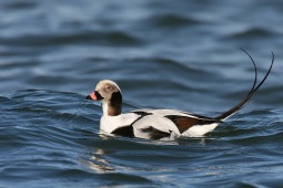
Long-tailed duck
The long-tailed duck, once known in North America as the oldsquaw, is a fascinating medium-sized sea duck and the sole surviving member of the Clangula genus. Initially classified under Harelda, it later became the type species of its own genus.
Birds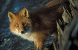
Red fox
The red fox, the largest member of the true fox family, inhabits the Northern Hemisphere, including regions in North America, Europe, Asia, and parts of Africa. This versatile animal thrives in a variety of environments and maintains a diverse diet.
Mammals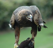
Golden eagle
The golden eagle, a majestic bird of prey revered across the Northern Hemisphere, belongs to the Accipitridae family. These eagles are easily identified by their dark brown feathers accented with striking golden-brown patches on their necks.
Birds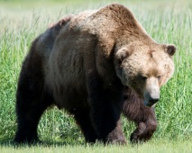
Brown (Grizzly) Bear
The brown bear, scientifically known as Ursus arctos, roams across Eurasia and North America. In North America, these majestic creatures are commonly referred to as grizzly bears. They are among the largest terrestrial carnivores, with only the polar bear rivaling...
Mammals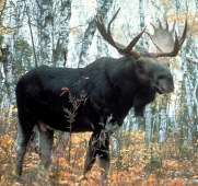
Moose, Elk
The moose, scientifically known as Alces alces and referred to as elk in British English, is the largest member of the deer family. Male moose are easily identifiable by their broad, palmate antlers, distinguishing them from other deer species.
Mammals