Broadway, Winnipeg
Map
Facts and practical information
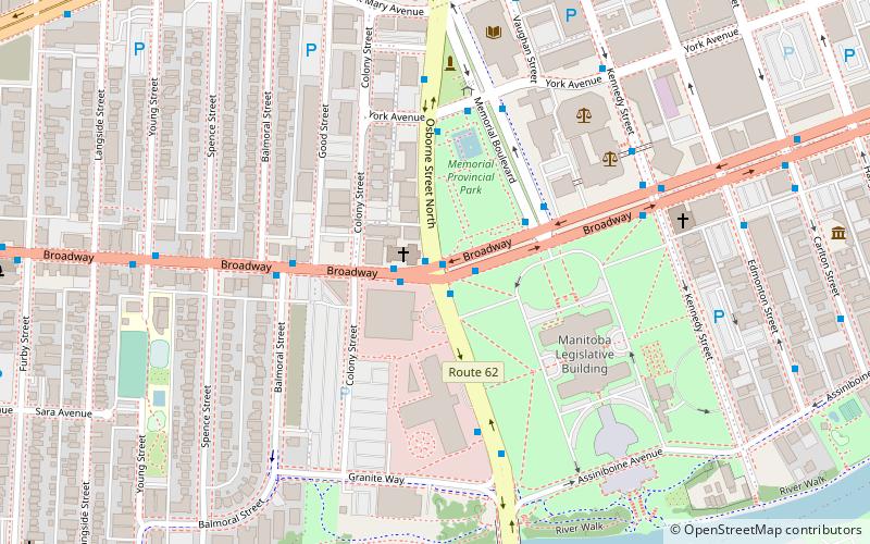
Broadway is a street in the city of Winnipeg, Manitoba, Canada. It is one of the city's oldest and most historic routes and forms the Trans-Canada Highway route through the city's downtown. ()
Coordinates: 49°53'8"N, 97°8'59"W
Address
Central Winnipeg (Downtown Winnipeg)Winnipeg
ContactAdd
Social media
Add
Getting there by public transportation
Public transportation stops near this location
- Bus
- Train
 Bus
Bus
- Calculate routeWestbound Broadway at Osborne East 1 min walk
- Calculate routeSouthbound Osborne at Broadway 1 min walk
- Calculate routeNorthbound Osborne at Broadway 1 min walk
- Calculate routeEastbound Broadway at Osborne 1 min walk
- Calculate routeWinnipeg 19 min walk
Day trips


Frequently Asked Questions (FAQ)
Which popular attractions are close to Broadway?
Nearby attractions include Statue of Queen Victoria, Winnipeg (3 min walk), Golden Boy, Winnipeg (4 min walk), Manitoba Legislative Building, Winnipeg (5 min walk), Archives of Manitoba, Winnipeg (6 min walk).
How to get to Broadway by public transport?
The nearest stations to Broadway:
Bus
Train
Bus
- Westbound Broadway at Osborne East • Lines: 10, 17, 20, 23 (1 min walk)
- Southbound Osborne at Broadway • Lines: 16, 18, 58, 60 (1 min walk)
Train
- Winnipeg (19 min walk)