Congregation Beth Israel, Vancouver
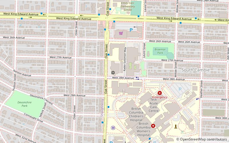
Map
Facts and practical information
Congregation Beth Israel is an egalitarian Conservative synagogue located at 989 West 28th Avenue in Vancouver, British Columbia. It was founded in 1925, but did not formally incorporate until 1932. Its first rabbi was Ben Zion Bokser, hired that year. He was succeeded the following year by Samuel Cass. Other rabbis included David Kogen, Bert Woythaler, and Wilfred Solomon, who served for decades starting in 1964. ()
Completed: 1949 (77 years ago)Coordinates: 49°14'48"N, 123°7'37"W
Getting there by public transportation
Public transportation stops near this location
- Metro
- Bus
- Trolleybus
 Metro
Metro
- Calculate routeOak St at West 27th Ave 2 min walk
- Calculate routeOak Street at Devonshire Crescent 4 min walk
- Calculate routeWest King Edward Ave at Oak St 5 min walk
- Calculate routeKing Edward 14 min walk
- Calculate routeOakridge-41st Avenue 27 min walk
- Calculate routeBroadway-City Hall 32 min walk
Maps SkyTrain
SkyTrainDay trips


Frequently Asked Questions (FAQ)
Which popular attractions are close to Congregation Beth Israel?
Nearby attractions include South Cambie, Vancouver (7 min walk), Shaughnessy, Vancouver (8 min walk), VanDusen Botanical Garden, Vancouver (14 min walk), Congregation Schara Tzedeck, Vancouver (15 min walk).
How to get to Congregation Beth Israel by public transport?
The nearest stations to Congregation Beth Israel:
Trolleybus
Bus
Metro
Trolleybus
- Oak St at West 27th Ave • Lines: 17 (2 min walk)
- Oak Street at Devonshire Crescent • Lines: 17 (4 min walk)
Bus
- West King Edward Ave at Oak St • Lines: 25 (5 min walk)
Metro
- King Edward • Lines: Canada Line (14 min walk)
- Oakridge-41st Avenue • Lines: Canada Line (27 min walk)