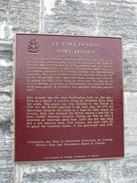
Fort Lennox, Île aux Noix

Gallery (2)
Map
Map
Gallery
Facts and practical information
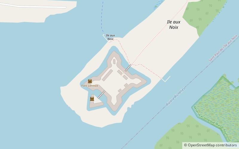
Fort Lennox occupies most of Île aux Noix, an island in the middle of the Richelieu River in the parish of Saint-Paul-de-l'Île-aux-Noix, Quebec, near the Canada-U.S. border. The fort features restored defence works and stonework buildings, and is surrounded by a star-shaped moat. ()
Built: 1819 (207 years ago)Coordinates: 45°7'17"N, 73°16'3"W
Day trips
Fort Lennox – popular in the area (distance from the attraction)
Nearby attractions include: Lacolle Mills Blockhouse.
