Silver Springs Golf & Country Club, Calgary

Facts and practical information
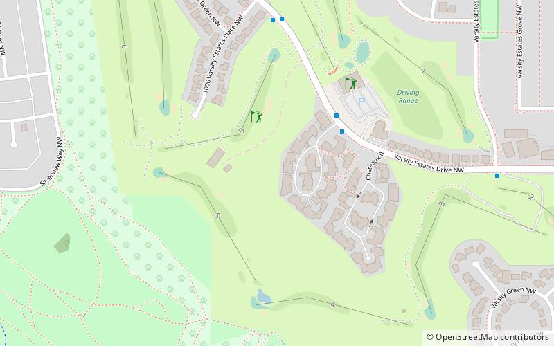
Silver Springs Golf & Country Club (address: 1600 Varsity Estates Drive NW) is a place located in Calgary (Alberta province) and belongs to the category of golf.
It is situated at an altitude of 3625 feet, and its geographical coordinates are 51°5'47"N latitude and 114°10'26"W longitude.
Planning a visit to this place, one can easily and conveniently get there by public transportation. Silver Springs Golf & Country Club is a short distance from the following public transport stations: 40 Avenue (bus, 16 min walk), Dalhousie (light rail, 19 min walk).
Among other places and attractions worth visiting in the area are: Dale Hodges Park (park, 17 min walk), Bowness (neighbourhood, 30 min walk), Market Mall (shopping, 30 min walk).
1600 Varsity Estates Drive NWNorthwest Calgary (Varsity)Calgary
- Bus
- Light rail
 Bus
Bus
- Calculate route40 Avenue 16 min walk
- Calculate routeDalhousie 22 min walk
- Calculate routeDalhousie 19 min walk


Frequently Asked Questions (FAQ)
How to get to Silver Springs Golf & Country Club by public transport?
Bus
- 40 Avenue (16 min walk)
- Dalhousie (22 min walk)
Light rail
- Dalhousie • Lines: 201 (19 min walk)