Southdale, Dartmouth
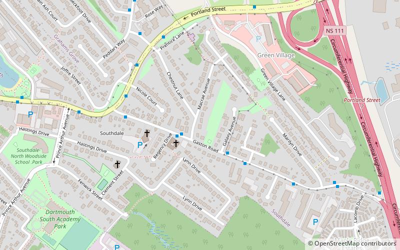
Map
Facts and practical information
Southdale is a neighbourhood located between the neighbourhoods of Woodside and Manor Park in the community of Dartmouth, in the Halifax Regional Municipality, Nova Scotia. The primary street is Portland Street which forms part of Route 207. A small lake called Maynard Lake is located within the neighbourhood. ()
Coordinates: 44°40'0"N, 63°32'28"W
Address
Dartmouth CentreDartmouth
ContactAdd
Social media
Add
Getting there by public transportation
Public transportation stops near this location
- Bus
 Bus
Bus
- Calculate routePenhorn Terminal 8 min walk
- Calculate route8416 - Valleyfield Rd After Oakwood Ave 24 min walk
- Calculate route8319 - Spikenard St Before Valleyfield Rd 25 min walk
- Calculate route9076 - Tacoma Dr After Hartlen St 25 min walk
Day trips


Frequently Asked Questions (FAQ)
Which popular attractions are close to Southdale?
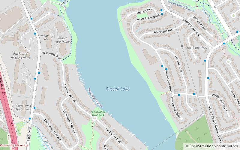
Nearby attractions include Maynard Lake, Dartmouth (16 min walk), Grahams Corner, Dartmouth (20 min walk), North Woodside Community Centre, Dartmouth (22 min walk), Russell Lake, Dartmouth (23 min walk).
How to get to Southdale by public transport?
The nearest stations to Southdale:
Bus
Bus
- Penhorn Terminal (8 min walk)
- 8416 - Valleyfield Rd After Oakwood Ave • Lines: 10 (24 min walk)