Renfrew–Collingwood, Vancouver
Map
Facts and practical information
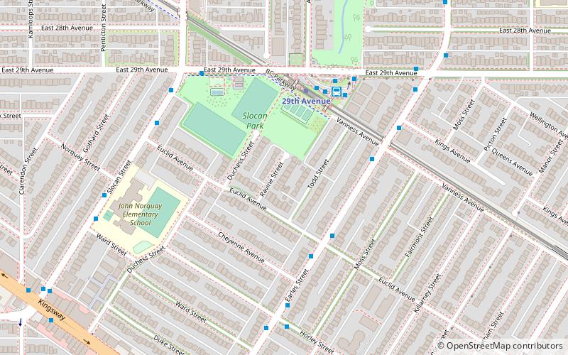
Renfrew–Collingwood is a large neighbourhood that lies on the eastern side of Vancouver, British Columbia, Canada, on its boundary with Burnaby and encompassing an area that was one of the earlier developed regions of the city. It is a diverse area that includes a substantial business community in several areas, as well as some of the fastest-growing residential sectors of Vancouver. In 2011, the neighbourhood had a population of 50,500, 38.4% of whom claim Chinese as their first language. ()
Coordinates: 49°14'33"N, 123°2'48"W
Address
Renfrew-CollingwoodVancouver
ContactAdd
Social media
Add
Getting there by public transportation
Public transportation stops near this location
- Metro
- Bus
- Trolleybus
 Metro
Metro
- Calculate routeEarles St at Euclid Ave 3 min walk
- Calculate route29th Avenue Station Bay 2 4 min walk
- Calculate route29th Avenue Station Bay 1 4 min walk
- Calculate route29th Avenue 4 min walk
- Calculate routeNanaimo 15 min walk
- Calculate routeJoyce–Collingwood 19 min walk
- Calculate routeRenfrew 29 min walk
- Calculate route29th Avenue Station Bay 3 4 min walk
- Calculate routeEast 29th Ave at Nootka St 6 min walk
- Calculate routeNootka St at East 27th Ave 9 min walk
Maps SkyTrain
SkyTrainDay trips


Frequently Asked Questions (FAQ)
Which popular attractions are close to Renfrew–Collingwood?
Nearby attractions include East Vancouver, Vancouver (13 min walk), Filipino Plaza, Vancouver (19 min walk), First Lutheran Church, Vancouver (20 min walk).
How to get to Renfrew–Collingwood by public transport?
The nearest stations to Renfrew–Collingwood:
Bus
Metro
Trolleybus
Bus
- Earles St at Euclid Ave • Lines: 26 (3 min walk)
- 29th Avenue Station Bay 2 • Lines: 29 (4 min walk)
Metro
- 29th Avenue • Lines: Expo Line (4 min walk)
- Nanaimo • Lines: Expo Line (15 min walk)
Trolleybus
- 29th Avenue Station Bay 3 • Lines: 16 (4 min walk)
- East 29th Ave at Nootka St • Lines: 16 (6 min walk)