Jeanne-Mance Street, Montreal
Map
Facts and practical information
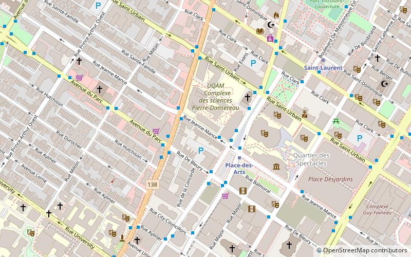
Jeanne Mance Street is a north–south street in Montreal, Quebec, Canada, located east of Park Avenue. It was named in 1914 in honour of Jeanne Mance, the founder of the Hôtel-Dieu de Montréal, which is also located along this street. ()
Coordinates: 45°30'32"N, 73°34'11"W
Address
Ville-Marie District (Quartier Ville-Marie)Montreal
ContactAdd
Social media
Add
Getting there by public transportation
Public transportation stops near this location
- Metro
- Bus
- Train
 Metro
Metro
- Calculate routeJeanne-Mance / du Président-Kennedy 1 min walk
- Calculate routeStation Place-des-Arts 2 min walk
- Calculate routeSherbrooke / Jeanne-Mance 2 min walk
- Calculate routeStation Place-des-Arts / Jeanne-Mance 2 min walk
- Calculate routePlace-des-Arts 3 min walk
- Calculate routeSaint-Laurent 8 min walk
- Calculate routeMcGill 9 min walk
- Calculate routePlace d’Armes 14 min walk
- Calculate routeMontreal Central Station 16 min walk
- Calculate routeLucien-L'Allier 26 min walk
Maps Metro
Metro
MetroDay trips


Frequently Asked Questions (FAQ)
Which popular attractions are close to Jeanne-Mance Street?
Nearby attractions include Black Watch Armoury, Montreal (2 min walk), Sherbrooke Street, Montreal (3 min walk), Church of St. John the Evangelist, Montreal (3 min walk), Salle Wilfrid-Pelletier, Montreal (4 min walk).
How to get to Jeanne-Mance Street by public transport?
The nearest stations to Jeanne-Mance Street:
Bus
Metro
Train
Bus
- Jeanne-Mance / du Président-Kennedy • Lines: 125-E, 129-N (1 min walk)
- Station Place-des-Arts • Lines: 125-O (2 min walk)
Metro
- Place-des-Arts • Lines: 1 (3 min walk)
- Saint-Laurent • Lines: 1 (8 min walk)
Train
- Montreal Central Station (16 min walk)
- Lucien-L'Allier (26 min walk)