Victoria City, Victoria
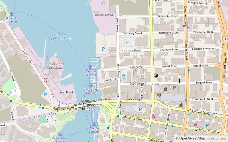
Map
Facts and practical information
Victoria City was a federal electoral district in British Columbia, Canada, that was represented in the House of Commons of Canada from 1904 to 1924. This riding was created in 1903 from Victoria riding. It was identical at the time of its creation to the provincial electoral district of the same name. It was abolished in 1924 into a new Victoria riding. ()
Coordinates: 48°25'48"N, 123°22'12"W
Address
Downtown VictoriaVictoria
ContactAdd
Social media
Add
Getting there by public transportation
Public transportation stops near this location
- Bus
- Ferry
 Bus
Bus
- Calculate routePandora at Government 4 min walk
- Calculate routeWharf at Yates 6 min walk
- Calculate routeGovernment at Johnson 6 min walk
- Calculate routeDouglas at Herald 7 min walk
- Calculate routeVictoria 15 min walk
Day trips


Frequently Asked Questions (FAQ)
Which popular attractions are close to Victoria City?
Nearby attractions include Chinatown, Victoria (3 min walk), Gate of Harmonious Interest, Victoria (4 min walk), Market Square, Victoria (4 min walk), Fan Tan Alley, Victoria (5 min walk).
How to get to Victoria City by public transport?
The nearest stations to Victoria City:
Bus
Ferry
Bus
- Pandora at Government • Lines: 14, 15, 24, 25 (4 min walk)
- Wharf at Yates • Lines: 10, 14, 15 (6 min walk)
Ferry
- Victoria • Lines: Seattle-Victoria, Victoria - Port Angeles (15 min walk)