South Cambie, Vancouver
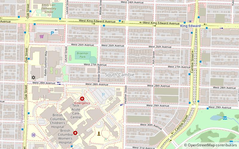
Map
Facts and practical information
South Cambie is a neighbourhood in the city of Vancouver, British Columbia, Canada, that is generally considered one of the smallest neighbourhoods in the city, both in size and in population. It is wedged between one of the city's largest parks and the upscale neighbourhood of Shaughnessy, and is known for a large cluster of medical facilities. ()
Coordinates: 49°14'48"N, 123°7'15"W
Address
CambieVancouver
ContactAdd
Social media
Add
Getting there by public transportation
Public transportation stops near this location
- Metro
- Bus
- Trolleybus
 Metro
Metro
- Calculate routeWest King Edward Ave at Willow St 5 min walk
- Calculate routeCambie Street at West 27th Avenue 7 min walk
- Calculate routeKing Edward 8 min walk
- Calculate routeOakridge-41st Avenue 25 min walk
- Calculate routeBroadway-City Hall 30 min walk
- Calculate routeOak St at West 27th Ave 8 min walk
- Calculate routeOak Street at Devonshire Crescent 9 min walk
Maps SkyTrain
SkyTrainDay trips


Frequently Asked Questions (FAQ)
Which popular attractions are close to South Cambie?
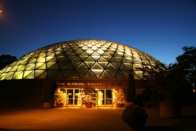
Nearby attractions include Congregation Beth Israel, Vancouver (7 min walk), Bloedel Floral Conservatory, Vancouver (12 min walk), Little Mountain, Vancouver (13 min walk), Shaughnessy, Vancouver (15 min walk).
How to get to South Cambie by public transport?
The nearest stations to South Cambie:
Bus
Metro
Trolleybus
Bus
- West King Edward Ave at Willow St • Lines: 25 (5 min walk)
- Cambie Street at West 27th Avenue • Lines: 15, 33 (7 min walk)
Metro
- King Edward • Lines: Canada Line (8 min walk)
- Oakridge-41st Avenue • Lines: Canada Line (25 min walk)
Trolleybus
- Oak St at West 27th Ave • Lines: 17 (8 min walk)
- Oak Street at Devonshire Crescent • Lines: 17 (9 min walk)