Denison Armoury, Toronto

Gallery (1)
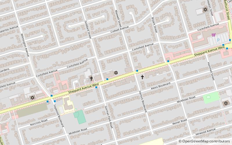
Map

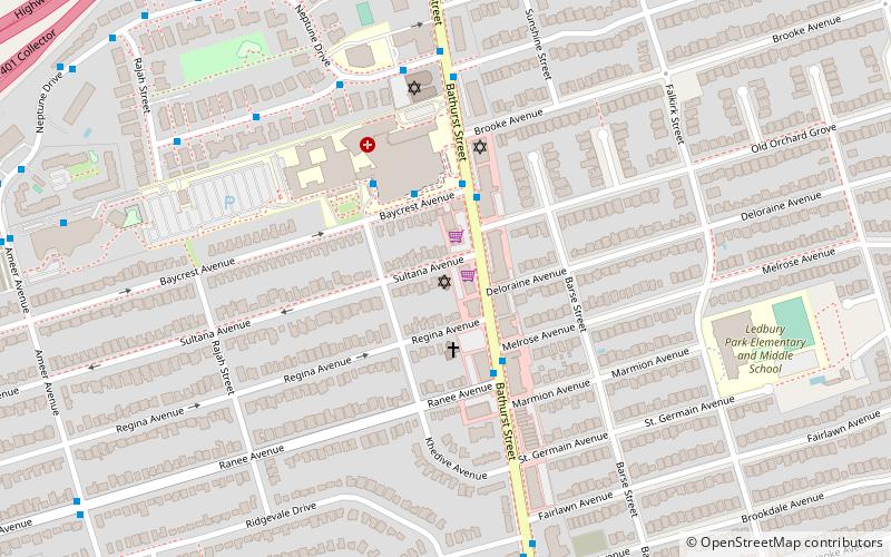
Map
Facts and practical information
Lieutenant-Colonel George Taylor Denison III Armoury, commonly known as Denison Armoury, is a Canadian Armed Forces facility located at 1 Yukon Lane in Toronto, Ontario, Canada. It is in the northeastern corner of Downsview Airport, just west of the W.R. Allen Expressway on Sheppard Avenue West. ()
Coordinates: 43°45'10"N, 79°28'8"W
Address
North York (Downsview)Toronto
ContactAdd
Social media
Add
Getting there by public transportation
Public transportation stops near this location
- Metro
- Bus
- Train
 Metro
Metro
- Calculate routeKodiak Crescent at Sheppard Avenue 3 min walk
- Calculate route44 Kodiak Crescemt 4 min walk
- Calculate routeOpposite 25 Kodiak Crescent 5 min walk
- Calculate routeWhitehorse Road at Rimrock Road 7 min walk
- Calculate routeSheppard West 11 min walk
- Calculate routeDownsview Park 13 min walk
- Calculate routeFinch West 36 min walk
- Calculate routeDownsview Park 12 min walk
Maps SubwayMaps
 Streetcar systemMaps
 PATH
PATH
SubwayMapsStreetcar systemMapsPATHDay trips


Frequently Asked Questions (FAQ)
How to get to Denison Armoury by public transport?
The nearest stations to Denison Armoury:
Bus
Metro
Train
Bus
- Kodiak Crescent at Sheppard Avenue • Lines: 107 (3 min walk)
- 44 Kodiak Crescemt • Lines: 107 (4 min walk)
Metro
- Sheppard West • Lines: 1 (11 min walk)
- Downsview Park • Lines: 1 (13 min walk)
Train
- Downsview Park (12 min walk)