Coquitlam Town Centre, Coquitlam
Map
Facts and practical information
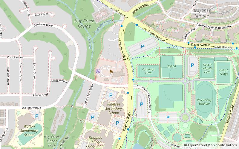
Coquitlam Town Centre is the main commercial and retail neighbourhood for the city of Coquitlam, British Columbia. Coquitlam Town Centre covers 723 hectares. The Town Centre also contains the highest concentration of high-rise condominiums in the Tri-Cities and northeastern Metro Vancouver. ()
Coordinates: 49°17'29"N, 122°47'26"W
Address
Town CentreCoquitlam
ContactAdd
Social media
Add
Getting there by public transportation
Public transportation stops near this location
- Metro
- Bus
 Metro
Metro
- Calculate routePinetree Way at Pinewood Ave 2 min walk
- Calculate routeDavid Ave at Pinetree Way 5 min walk
- Calculate routeLafarge Lake–Douglas 11 min walk
- Calculate routeLincoln 20 min walk
- Calculate routeCoquitlam Central 32 min walk
Day trips


Frequently Asked Questions (FAQ)
Which popular attractions are close to Coquitlam Town Centre?
Nearby attractions include Town Centre Park, Coquitlam (6 min walk), Percy Perry Stadium, Coquitlam (8 min walk), Lafarge Lake, Coquitlam (9 min walk), Evergreen Cultural Centre, Coquitlam (11 min walk).
How to get to Coquitlam Town Centre by public transport?
The nearest stations to Coquitlam Town Centre:
Bus
Metro
Bus
- Pinetree Way at Pinewood Ave • Lines: 183, 186, 188, 191 (2 min walk)
- David Ave at Pinetree Way • Lines: 186, 188, 191 (5 min walk)
Metro
- Lafarge Lake–Douglas • Lines: Millennium Line (11 min walk)
- Lincoln • Lines: Millennium Line (20 min walk)