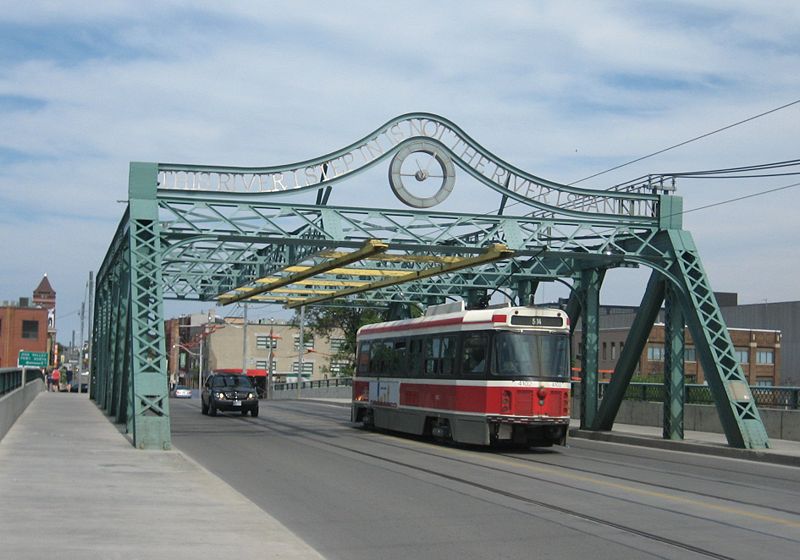
Queen Street Viaduct, Toronto

Gallery (2)
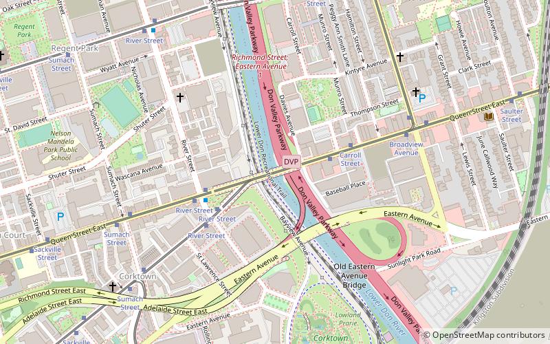
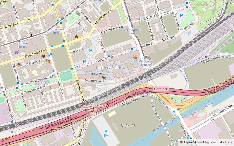
Map
Map
Gallery
Facts and practical information
The Queen Street Viaduct in Toronto, Canada carries vehicles and Toronto Transit Commission streetcars along Queen Street East and across the Don River. It is an example of a Pratt truss. ()
Opened: 1911 (115 years ago)Length: 129 ftCoordinates: 43°39'28"N, 79°21'15"W
Getting there by public transportation
Public transportation stops near this location
- Metro
- Bus
- Tram
 Metro
Metro
- Calculate routeCarroll Street 3 min walk
- Calculate routeRiver Street 4 min walk
- Calculate routeQueen Street East 3 min walk
- Calculate routeKing Street East 4 min walk
- Calculate routeDundas Street East 8 min walk
- Calculate routeFront Street East 8 min walk
- Calculate routeCastle Frank 34 min walk
- Calculate routeKing 34 min walk
- Calculate routeSherbourne 38 min walk
Maps SubwayMaps
 Streetcar systemMaps
 PATH
PATH
SubwayMapsStreetcar systemMapsPATHDay trips


Frequently Asked Questions (FAQ)
Which popular attractions are close to Queen Street Viaduct?
Nearby attractions include Old Eastern Avenue Bridge, Toronto (3 min walk), Underpass Park, Toronto (4 min walk), West Don Lands, Toronto (6 min walk), Corktown Common, Toronto (9 min walk).
How to get to Queen Street Viaduct by public transport?
The nearest stations to Queen Street Viaduct:
Tram
Bus
Metro
Tram
- Carroll Street • Lines: 501, 501;301, 504B (3 min walk)
- River Street • Lines: 501, 501;301, 504B (4 min walk)
Bus
- Queen Street East • Lines: 121 (3 min walk)
- King Street East • Lines: 121 (4 min walk)
Metro
- Castle Frank • Lines: 2 (34 min walk)
- King • Lines: 1 (34 min walk)