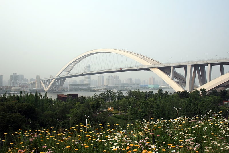
Xupu Bridge, Shanghai

Gallery (1)
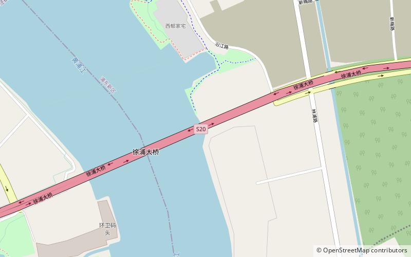
Map
Map
Facts and practical information
The Xupu Bridge, is a cable-stayed bridge over the Huangpu River in Shanghai, China, so named because it connects the city's Xuhui and Pudong districts. It opened in 1997 and carries 8 lanes of the S20 Outer Ring Expressway. ()
Address
浦东 (pu dong)Shanghai
ContactAdd
Social media
Add
Getting there by public transportation
Public transportation stops near this location
- Metro
- Bus
 Metro
Metro
- Calculate routeLingzhao Xincun 35 min walk
- Calculate route上浦路济阳路 41 min walk
Day trips


Frequently Asked Questions (FAQ)
How to get to Xupu Bridge by public transport?
The nearest stations to Xupu Bridge:
Metro
Bus
Metro
- Lingzhao Xincun • Lines: 8 (35 min walk)
Bus
- 上浦路济阳路 • Lines: 973 (41 min walk)