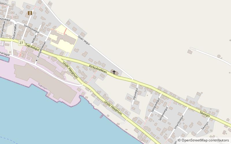
Church of Tvoroyri, Tvøroyri
#1 among attractions in Tvøroyri

Facts and practical information
Church of Tvoroyri is a national church in Tvøroyri, Faroe Islands. It was constructed in Norway as a building set, moved to Tvøroyri and then built there in 1908. ()
Tvøroyri Faroe Islands
Tvøroyri plan & book
Unleash the traveler in you — discover the cheapest flight deals, find the perfect hotel or hostel nearby, and search for the best car rental prices. Travel at your own pace to discover new places and enjoy your journey.
Church of Tvoroyri – popular in the area (distance from the attraction)
Nearby attractions include: Fámjin stone, Porkeri Church, Krambatangi, Trongisvágsfjørður.
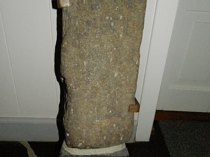 Church, Stela
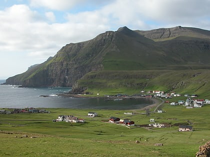
Fámjin stone, Fámjin
83 min walk • The Fámjin stone is a runestone located in the church of Fámjin on the Faroe Islands. The stone bears both Latin and Runic letters. The stone is dated to the time after the Faroese reformation in 1538, and proves that runes were used up to as late as the 16th century. It is the youngest of the Faroese runestones.
 Architecture, Church
Porkeri Church, Porkeri
137 min walk • Porkeri Church is a church in the settlement of Porkeri in the Faroe Islands. Porkeri is situated on the island of Suðuroy, which is the southernmost of the islands. It is a wooden church and it has a roof of turf.
 Harbor
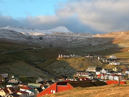
Krambatangi, Tvøroyri
18 min walk • Krambatangi is the ferry port of Suðuroy in the Faroe Islands. The ferry MS Smyril M/F disembarks 2–3 times daily from Krambatangi to Tórshavn.
 Natural attraction, Nature, Fjord
Trongisvágsfjørður
18 min walk • Trongisvágsfjørður is a fjord on the island of Suðuroy in the Faroe Islands. There are four villages around the fjord. Furthest east on the northern side of the fjord is Froðba, in the bottom of the fjord is Trongisvágur. In between Trongisvágur and Froðba is Tvøroyri, the largest of these villages.
 Nature, Natural attraction, Mountain
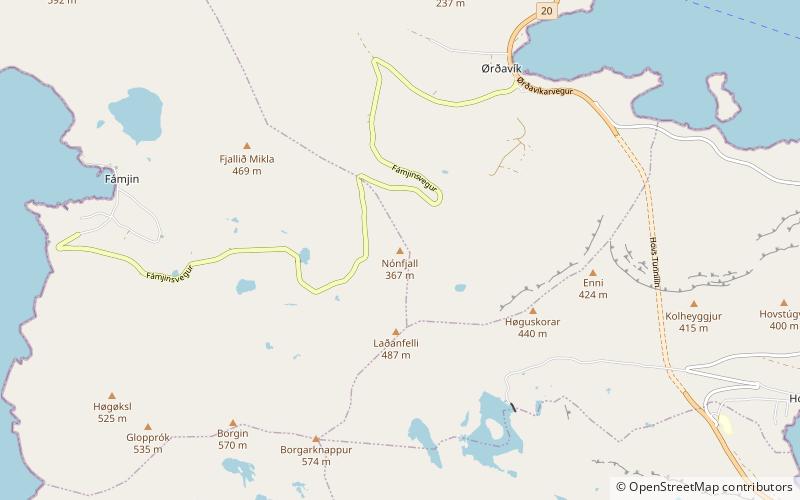
Nónfjall, Suðuroy
67 min walk • Nónfjall is a 367-metre-high mountain on the island Vágar in the Faroe Islands, the mountain is located south of the village of Sørvágur, near Vágar Airport and east of the mountain Høgafjall. The name Nónfjall translates to 'Noon mountain'.
 Nature, Natural attraction, Lake
Kirkjuvatn, Fámjin
80 min walk • Kirkjuvatn is a lake in Suðuroy, Faroe Islands. The lake is located just north of the village of Fámjin, which is located on the west coast of Suðuroy. Fámjin is the only village on the island which is facing directly west. Only one other village, Sumba is also located on the west coast, but Sumba is facing south-west.
 Nature, Natural attraction, Mountain
Borgarknappur, Suðuroy
99 min walk • Borgarknappur is a mountain in Suðuroy, Faroe Islands. The mountain is 574 metres high. It is located in the center of the island, west of the village Hov and south-east of Fámjin, south-west of Øravík and north of Vágur.
 Nature, Natural attraction, Mountain
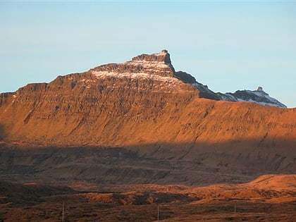
Gluggarnir, Suðuroy
56 min walk • Gluggarnir is a mountain in the Faroe Islands. At 610 metres, it is the highest mountain on the southernmost island, Suðuroy. The mountain is located between the villages of Fámjin and Trongisvágur.
 Nature, Natural attraction, Mountain
Porkeri Mountains, Suðuroy
111 min walk • The Porkeri Mountains are a mountain range near the village of Porkeri in the Faroe Islands near the Porkeri Mountains, just north of Vágur on Suðuroy's east coast.
 Village
Hov
89 min walk • One of the highlights of a visit to Hov is exploring the village's rich history and cultural heritage. The Hov Church, with its striking red roof and white walls, is a beautiful example of traditional Faroese architecture and is a must-see for history enthusiasts.
 Village
Øravík
37 min walk • Øravík is a village on the east coast of the island of Suðuroy in the Faroe Islands. The village is located in the center of the island on a crossroad where the road to Fámjin goes towards west over the mountains to the west coast.


