Massif des Calanques, Marseille
Map

Map

Facts and practical information
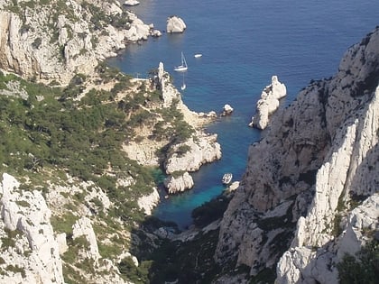
The Massif des Calanques is a wild and rugged terrain stretching from the ninth arrondissement of Marseille to the east towards Cassis, spanning 20 km in length and 4 km in width along the coast. Its highest peak is Mont Puget at 565m. The area has been protected by a national park since 2012. ()
Address
9éme Arrondissement (Les Baumettes)Marseille
ContactAdd
Social media
Add
Day trips
Massif des Calanques – popular in the area (distance from the attraction)
Nearby attractions include: Stade Vélodrome, Cosquer Cave, Plages du Prado, Parc Borély.
Frequently Asked Questions (FAQ)
How to get to Massif des Calanques by public transport?
The nearest stations to Massif des Calanques:
Bus
Bus
- Luminy Parc National des Calanques • Lines: 21Jet, 24, 521, B1 (27 min walk)
- Luminy Faculté • Lines: 21Jet, 24, 521, B1 (27 min walk)


