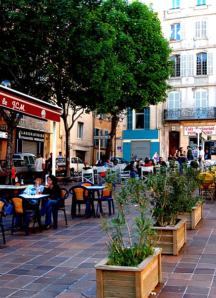
Place de Lenche, Marseille

Gallery (3)
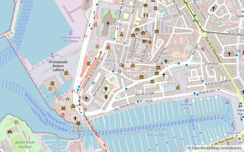
Map
Map
Gallery
Facts and practical information
The Place de Lenche, located near the Old Port, behind the city hall, is in the 2nd arrondissement of Marseille. In Greek times, it is possible that the agora was located here, making it the center of the Greek city.
Coordinates: 43°17'50"N, 5°21'57"E
Address
Place de Lenche2ème Arrondissement (Hôtel de Ville)Marseille 13002
Contact
Social media
Add
Getting there by public transportation
Public transportation stops near this location
- Metro
- Bus
- Tram
- Train
- Ferry
 Metro
Metro
- Calculate routePlace de Lenche 1 min walk
- Calculate routeCaisserie Beauregard 3 min walk
- Calculate routeTourette Cathédrale 3 min walk
- Calculate routeQuai du Port 4 min walk
- Calculate routeGare Maritime de la Major 11 min walk
- Calculate routeHôtel de Ville 7 min walk
- Calculate routePlace aux Huiles 10 min walk
- Calculate routeSadi Carnot 9 min walk
- Calculate routeRépublique Dames 10 min walk
- Calculate routeBelsunce Alcazar 14 min walk
- Calculate routeJoliette 15 min walk
- Calculate routeVieux Port 12 min walk
- Calculate routeColbert 13 min walk
- Calculate routeJoliette 13 min walk
- Calculate routeJules Guesde 14 min walk
- Calculate routeMarseille-Saint-Charles 23 min walk
- Calculate routeArenc-Euroméditerranée 29 min walk
Day trips
Place de Lenche – popular in the area (distance from the attraction)
Nearby attractions include: Vieux-Port, Marseille Cathedral, Museum of European and Mediterranean Civilisations, Fort Saint-Jean.


Frequently Asked Questions (FAQ)
Which popular attractions are close to Place de Lenche?
Nearby attractions include Museum of the Roman Docks, Marseille (3 min walk), Chapelle des Pénitents blancs du Saint-Esprit, Marseille (4 min walk), St. Lawrence Church, Marseille (5 min walk), Marseille Cathedral, Marseille (5 min walk).
How to get to Place de Lenche by public transport?
The nearest stations to Place de Lenche:
Bus
Ferry
Tram
Metro
Train
Bus
- Place de Lenche • Lines: 49 (1 min walk)
- Caisserie Beauregard • Lines: 49 (3 min walk)
Ferry
- Gare Maritime de la Major • Lines: Marseille - تونس, الجزائر - Marseille (11 min walk)
- Hôtel de Ville • Lines: Ferry (7 min walk)
Tram
- Sadi Carnot • Lines: T2, T3 (9 min walk)
- République Dames • Lines: T2, T3 (10 min walk)
Metro
- Vieux Port • Lines: M1 (12 min walk)
- Colbert • Lines: M1 (13 min walk)
Train
- Marseille-Saint-Charles (23 min walk)
- Arenc-Euroméditerranée (29 min walk)