Le Néron, Grenoble


Facts and practical information
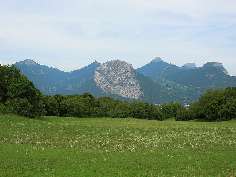
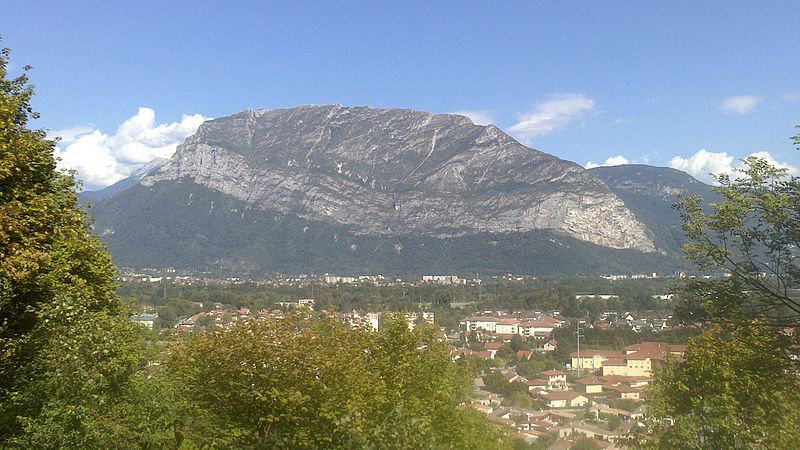
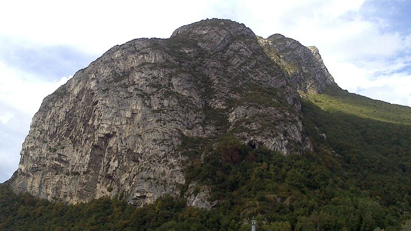
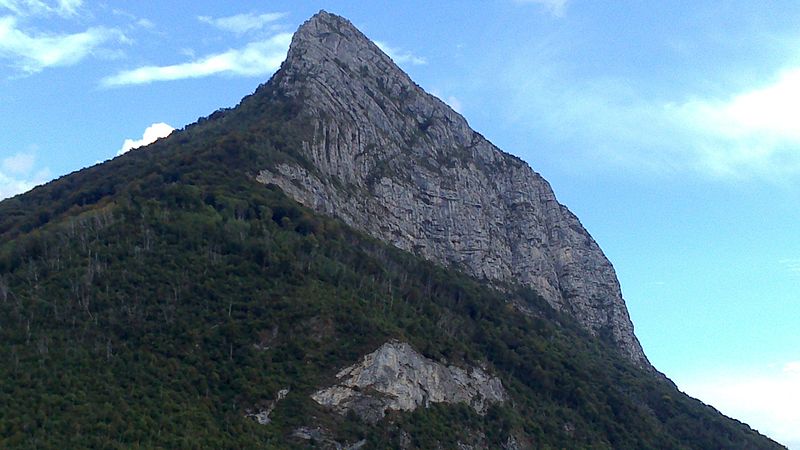
The Néron is a peak in the French department of Isère culminating at 1,299 meters above sea level in the Chartreuse massif, in the Alps. Sometimes called Nero's helmet in the 19th century because of its shape, its name literally means "the black one" and has no relation either with the Roman emperor or with the existence of an ancient post used as a lookout and refuge in its southern part. The mountain has the shape of an inverted boat hull with a main ridge oriented from north to south very pronounced and is composed mainly of urgonian limestone. Its exposure allows it to have a Mediterranean flora, although it has been weakened by the fire of the summer of 2003 that ravaged its entire upper part. The mountain is also part of the Chartreuse regional nature park.
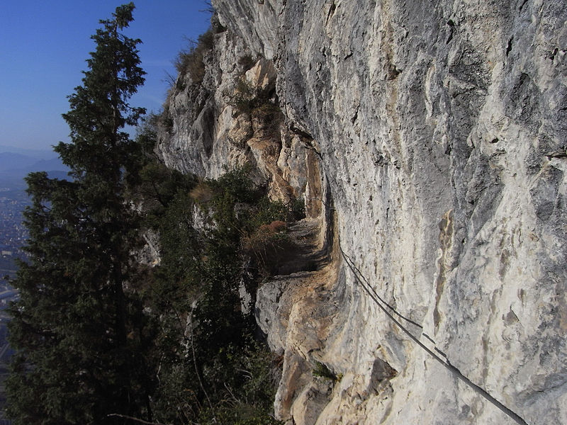
The southern end of the Néron is occupied by a cave called Balme de l'Hermitage. The site, occupied since the Neolithic period, hosts from the Middle Ages a luxurious villa, transformed into a castle, which passes in turn to the hands of rich families and religious orders. At that time, the forests on the slopes of the mountain were intensively exploited to supply the forges with charcoal and were largely replaced by vineyards. Thus, in the 19th century, the first scientific and military explorers used some of the steep trails made by the loggers. The Nero appeared in the Joanne Guides, but the number of victims quickly multiplied and it acquired a bad reputation. The first complete crossing from north to south was made in 1884 to evaluate the possibility of establishing military batteries on the summit of the mountain. Finally, the construction of a road was launched in 1891 to lead to the location of the batteries, which were completed two years later on the north side of the mountain, upstream from the Vence Gorge. At the same time, exploration of the Nero led to the discovery of the ancient Roman road and the remains of the ancient ten-meter long footbridge in the southeast escarpments. Subsequently, a series of archaeological excavations directed by Hippolyte Müller led to the discovery of the ancient watchtower and numerous artifacts. New accidents led to the creation of the Dauphinois mountain rescue committee, the marking of trails, the installation of cables and, in 1911, the inauguration of a new footbridge. The Roman path became the main route of the Néron, replacing the unstable corridors of the eastern face and the steep paths of the western slope. The Boujard inn, in the hamlet of Hermitage, flourished in the first half of the 20th century. However, the château de la Balme was burned down in 1932 and permanently abandoned. After the Second World War, except for the opening of a few climbing routes around the 1970s and the chronicles created by a work representing Lucky Luke on one of the peaks overlooking the Grenoble area, the Néron lost much of its appeal; municipal by-laws regularly forbid access because of rock falls and the abandonment of a large part of the trails.
Grenoble
- Bus
- Tram
 Bus
Bus
- Calculate routeRipaillère 19 min walk
- Calculate routeCol de Clémencières 20 min walk
- Calculate routeLe Gatinet 21 min walk
- Calculate routeChemin Vert 23 min walk
- Calculate routeLe Muret 34 min walk
- Calculate routeFiancey - Prédieu 34 min walk
- Calculate routeNéron 37 min walk


Frequently Asked Questions (FAQ)
How to get to Le Néron by public transport?
Bus
- Ripaillère • Lines: 55 (19 min walk)
- Col de Clémencières • Lines: 55, 56 (20 min walk)
Tram
- Le Muret • Lines: E (34 min walk)
- Fiancey - Prédieu • Lines: E (34 min walk)