Villejuif, Paris

Gallery (2)
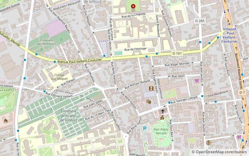
Map

Map
Gallery
Facts and practical information
Getting there by public transportation
Public transportation stops near this location
- Metro
- Bus
- Tram
 Metro
Metro
- Calculate routeGroupe Hospitalier Paul Brousse 2 min walk
- Calculate routeMairie de Villejuif 5 min walk
- Calculate routeÉdouard Vaillant - Cimetière 7 min walk
- Calculate routeVerdun–Grosménil 7 min walk
- Calculate routeVillejuif - Paul Vaillant-Couturier 10 min walk
- Calculate routeLe Kremlin-Bicêtre 30 min walk
- Calculate routeVillejuif-Louis Aragon 14 min walk
- Calculate routeLamartine 20 min walk
- Calculate routeBeethoven - Concorde 26 min walk
- Calculate routeGermaine Tailleferre 26 min walk
Maps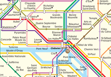 Metro
Metro
MetroDay trips


Frequently Asked Questions (FAQ)
How to get to Villejuif by public transport?
The nearest stations to Villejuif:
Bus
Metro
Tram
Bus
- Groupe Hospitalier Paul Brousse • Lines: 162, v7 (2 min walk)
- Mairie de Villejuif • Lines: v7 (5 min walk)
Metro
- Villejuif - Paul Vaillant-Couturier • Lines: 7 (10 min walk)
- Le Kremlin-Bicêtre • Lines: 7 (30 min walk)
Tram
- Villejuif-Louis Aragon • Lines: T7 (14 min walk)
- Lamartine • Lines: T7 (20 min walk)