Place d'Alliance, Nancy

Gallery (6)
Map


Map

Gallery
Facts and practical information
The Place d'Alliance is a square in Nancy, designed by the architect Emmanuel Héré. Located in Ville-neuve, the square is almost immediately adjacent to the famous Place Stanislas, and belongs to the same urban complex of classical style wanted by Stanislas Leszczynski, listed as a World Heritage Site by UNESCO since 1983.
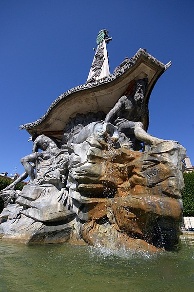
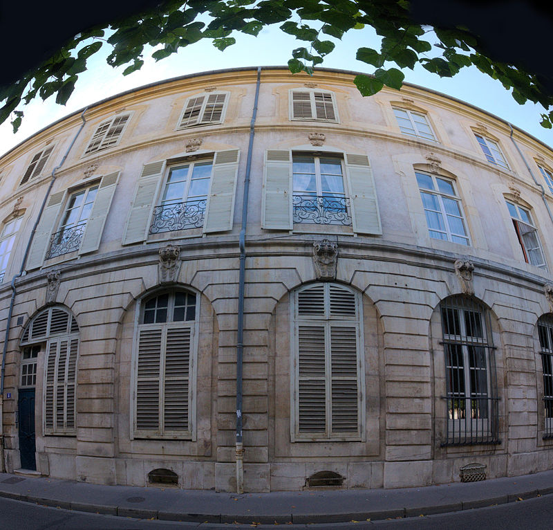
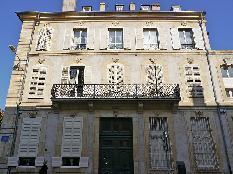
The central fountain, the double row of century-old lime trees, and the sober mansions lining the square give the place a calm and austere atmosphere.
Address
Centre Ville - Charles III (Charles III Nord - Tiercelins - St-Georges)Nancy
ContactAdd
Social media
Add
Getting there by public transportation
Public transportation stops near this location
- Bus
- Tram
- Train
 Bus
Bus
- Calculate routeCathédrale 4 min walk
- Calculate routeDivision de Fer 5 min walk
- Calculate routePoint Central 8 min walk
- Calculate routeSaint-Georges 11 min walk
- Calculate routePlace Stanislas 5 min walk
- Calculate routeFaïencerie 7 min walk
- Calculate routeAmerval 7 min walk
- Calculate routePlace Stanislas Dom Calmet 8 min walk
- Calculate routeNancy-Ville 17 min walk
Day trips


Frequently Asked Questions (FAQ)
Which popular attractions are close to Place d'Alliance?
Nearby attractions include Opéra National de Lorraine, Nancy (3 min walk), Muséum-Aquarium de Nancy, Nancy (3 min walk), Jardin Dominique Alexandre Godron, Nancy (4 min walk), Place Stanislas, Nancy (4 min walk).
How to get to Place d'Alliance by public transport?
The nearest stations to Place d'Alliance:
Tram
Bus
Train
Tram
- Cathédrale • Lines: T1 (4 min walk)
- Division de Fer • Lines: T1 (5 min walk)
Bus
- Place Stanislas • Lines: Citadine 1 (5 min walk)
- Faïencerie • Lines: Citadine 1 (7 min walk)
Train
- Nancy-Ville (17 min walk)