Feu de Saint-Pol, Dunkirk
Map

Map

Facts and practical information
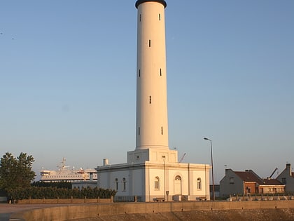
The Saint-Pol light is a lighthouse located at the end of the western pier of the port of Dunkirk, registered as a historical monument. Property of the State, it is considered to be transferred to local authorities. Paradoxically, it owes its name to Saint-Pol-sur-Mer, although it is located in Dunkirk.
Built in 1937-1938, it was lit in 1939, and is the last work of the architect Gustave Umbdenstock. It has been registered as a historical monument since December 31, 1999. It is no longer in service and its condition is worrying.
Coordinates: 51°3'38"N, 2°20'58"E
Address
Dunkirk
ContactAdd
Social media
Add
Day trips
Feu de Saint-Pol – popular in the area (distance from the attraction)
Nearby attractions include: Church of Saint-Éloi, Dunkirk lighthouse, Port Museum, Canal de Bergues.
Frequently Asked Questions (FAQ)
How to get to Feu de Saint-Pol by public transport?
The nearest stations to Feu de Saint-Pol:
Bus
Bus
- Bordées • Lines: C4 (40 min walk)
- Phares et Balises • Lines: C4 (42 min walk)


