Le Mas des Canelles, Labège

Gallery (1)
Map
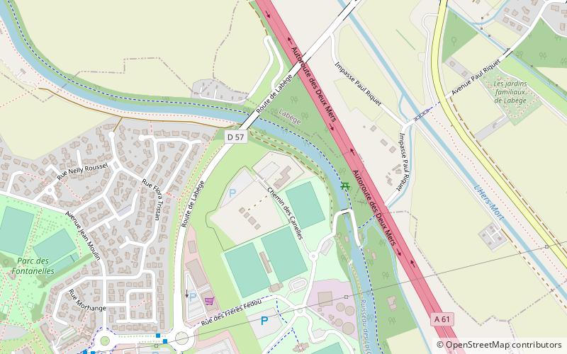
Map
Facts and practical information
Le Mas des Canelles (address: Chemin des Canelles) is a place located in Labège (Occitanie region) and belongs to the category of sightseeing.
It is situated at an altitude of 499 feet, and its geographical coordinates are 43°31'29"N latitude and 1°31'0"E longitude.
Among other places and attractions worth visiting in the area are: Petit Casino (shopping, 26 min walk), Castanet-Tolosan (locality, 27 min walk), Rieumory Aqueduct (aqueduct, 38 min walk).
Coordinates: 43°31'29"N, 1°31'0"E
Address
Chemin des CanellesLabège
ContactAdd
Social media
Add
Day trips