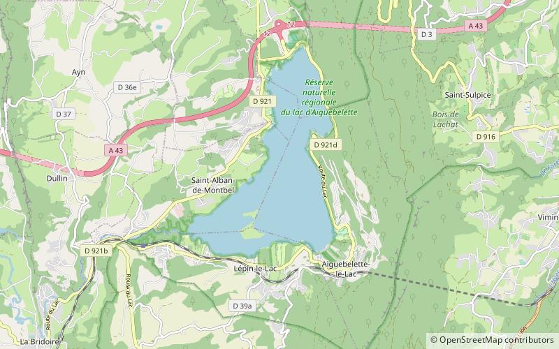
Lac d'Aiguebelette

Gallery (1)
Map
Map
Facts and practical information
Lac d'Aiguebelette is a natural lake in the commune of Aiguebelette-le-Lac, within the department of Savoie, France. ()
Alternative names: Area: 2.1 mi²Maximum depth: 233 ftElevation: 1224 ft a.s.l.Coordinates: 45°33'14"N, 5°47'55"E
Location
Auvergne-Rhône-Alpes
ContactAdd
Social media
Add
Day trips