Château d'Yèvre-le-Châtel
Map
![Château d'Yèvre-le-Châtel location map](https://tzmedia.b-cdn.net/media/images/static-maps/fr/48_1604_2_33471.jpg)
Map
![Château d'Yèvre-le-Châtel location map](https://tzmedia.b-cdn.net/media/images/static-maps/fr/48_1604_2_33471.jpg)
Facts and practical information
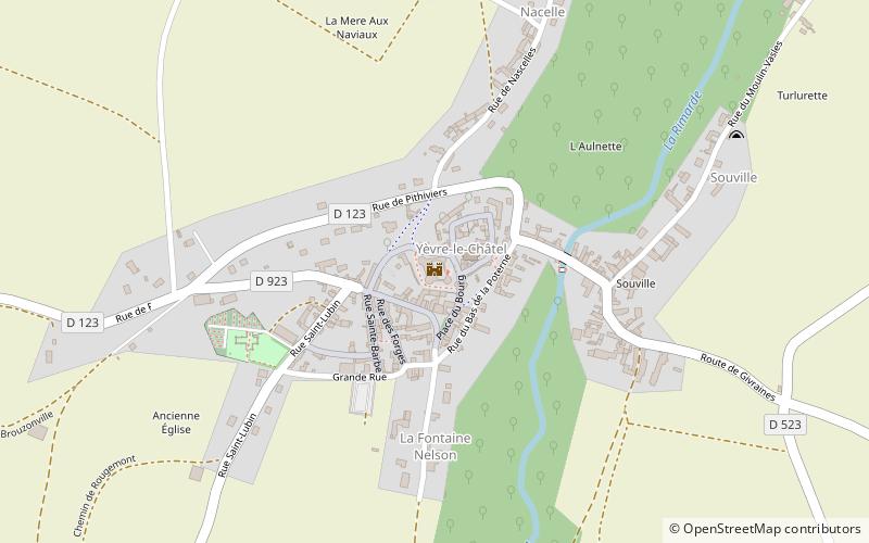
The Château d'Yèvre-le-Châtel is a ruined castle in the commune of Yèvre-la-Ville in the Loiret département of France. The castle dates from the first quarter of the 13th century and is located in the hamlet of Yèvre-le-Châtel, to the north of the commune. ()
Coordinates: 48°9'37"N, 2°20'5"E
Location
Centre-Loire Valley
ContactAdd
Social media
Add
Day trips
Château d'Yèvre-le-Châtel – popular in the area (distance from the attraction)
Nearby attractions include: Tramway de Pithiviers à Toury, Pithiviers internment camp, Église Saint-Salomon et Saint-Grégoire, Église Saint-Jacques le Majeur.