Trek Zone

Stade Jean-Antoine Moueix, Libourne
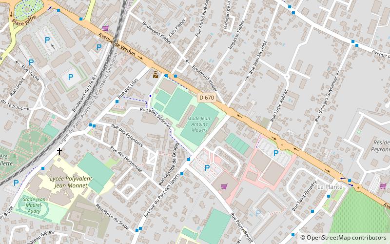
#3 among attractions in Libourne

Sport, Arenas and stadiums, Sport venue
Stade Jean-Antoine Moueix location map
Map

Facts and practical information

Local name: Stade Jean-Antoine-Moueix Opened: 1965 (59 years ago)Capacity: 8500Coordinates: 44°54'27"N, 0°14'3"W
Address

Libourne France

ContactAdd
Social media
Add
Day trips

Stade Jean-Antoine Moueix – popular in the area (distance from the attraction)

Nearby attractions include: Château Cheval Blanc, St. Martin's Church, Pétrus, Ponty vineyards.

  • chateau cheval blanc saint emilion2.3 miE
  • st martins church fronsac2.1 miNW
  • petrus pomerol2.6 miNE
  • ponty vineyards fronsac2.2 miNW
  • chateau petit village pomerol2 miNE
  • chateau beauregard pomerol location map
    1.9 miNE
  • chateau levangile pomerol2.4 miNE
  • chateau franc mayne saint emilion3.1 miE
  • chateau figeac saint emilion2.1 miE
  • chateau trotanoy pomerol location map
    2 miNE
  • chateau rouget pomerol2.6 miNE

Where to next? Visit new aquitaine New Aquitaine region page or discover the top tourist attractions in France.