Rue de Famars, Valenciennes

Facts and practical information
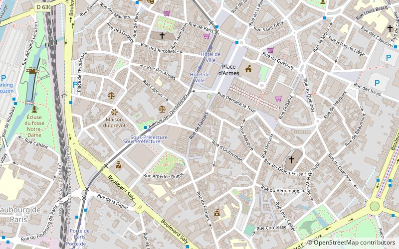
Rue de Famars is a place located in Valenciennes (Hauts-de-France region) and belongs to the category of square.
It is situated at an altitude of 89 feet, and its geographical coordinates are 50°21'23"N latitude and 3°31'19"E longitude.
Planning a visit to this place, one can easily and conveniently get there by public transportation. Rue de Famars is a short distance from the following public transport stations: Sous-Préfecture (bus, 3 min walk), Sous-Préfecture (tram, 3 min walk), Valenciennes (train, 14 min walk).
Among other places and attractions worth visiting in the area are: Centre Commercial Place d'Armes (shopping, 4 min walk), Hôtel de Ville de Valenciennes (city hall, 4 min walk), Église Saint-Géry (sacred and religious sites, 5 min walk).
Valenciennes
- Bus
- Tram
- Train
 Bus
Bus
- Calculate routeSous-Préfecture 3 min walk
- Calculate routePlace d'Armes 5 min walk
- Calculate routeEsplanade 7 min walk
- Calculate routePlace du Hainaut 7 min walk
- Calculate routeSous-Préfecture 3 min walk
- Calculate routeHôtel de Ville 4 min walk
- Calculate routePorte de Paris 8 min walk
- Calculate routeClemenceau 9 min walk
- Calculate routeValenciennes 14 min walk


Frequently Asked Questions (FAQ)
Which popular attractions are close to Rue de Famars?
How to get to Rue de Famars by public transport?
Bus
- Sous-Préfecture • Lines: C1 (3 min walk)
- Place d'Armes • Lines: C1 (5 min walk)
Tram
- Sous-Préfecture • Lines: T1, T2 (3 min walk)
- Hôtel de Ville • Lines: T1, T2 (4 min walk)
Train
- Valenciennes (14 min walk)