Trek Zone

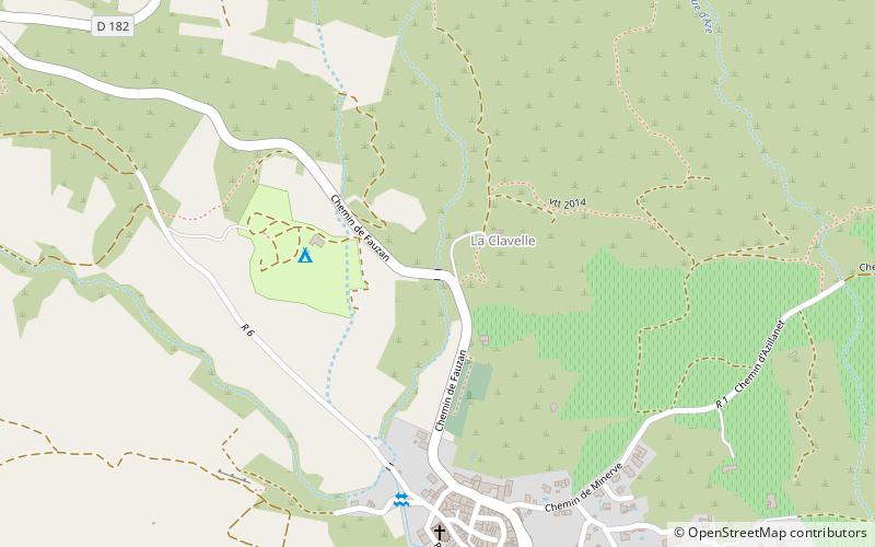
Chemin de Fauzan, Cesseras

#1 among attractions in Cesseras

Bridge
Chemin de Fauzan

Facts and practical information

Chemin de Fauzan (address: Chemin de Fauzan) is a place located in Cesseras (Occitanie region) and belongs to the category of bridge.

It is situated at an altitude of 384 feet, and its geographical coordinates are 43°19'45"N latitude and 2°42'48"E longitude.

Among other places and attractions worth visiting in the area are: Stade de l'Aiguille, Minerve (arenas and stadiums, 49 min walk), Saint Stephen's Church, Minerve (church, 62 min walk), Pépieux (locality, 71 min walk).

Coordinates: 43°19'45"N, 2°42'48"E
Address

Chemin de FauzanCesseras France

ContactAdd
Social media
Add

Cesseras plan & book

Unleash the traveler in you — discover the cheapest flight deals, find the perfect hotel or hostel nearby, and search for the best car rental prices. Travel at your own pace to discover new places and enjoy your journey.

Day trips

Chemin de Fauzan – popular in the area (distance from the attraction)

Nearby attractions include: Jouarres Aqueduct, Argent-Double Aqueduct, Homps Lock, Pechlaurier Lock.

  • jouarres aqueduct location map
    4.6 miS
  • argent double aqueduct la redorte5.9 miSW
  • homps lock4.2 miS
  • pechlaurier lock5.9 miS
  • ognon lock4.3 miS
  • beaufort oupia3.1 miSE
  • saint stephens church minerve2.4 miNE
  • ognon aqueduct location map
    4.3 miS
  • epanchoir dargentdouble la redorte location map
    5.9 miS
  • eglise saint julien et sainte basilisse azille4.5 miSW
  • eglise saint sernin pouzols minervois6.2 miSE

Where to next? Visit occitanie Occitanie region page or discover the top tourist attractions in France.