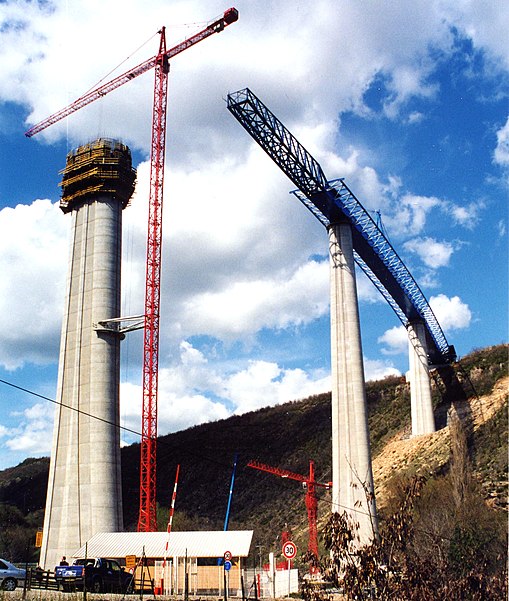
Verrières Viaduct

Gallery (2)
Map

Map
Gallery
Facts and practical information
The Verrières Viaduct is a curved 720-metre concrete autoroute box girder bridge in the south of France, which at one point was briefly the highest bridge in France; it is almost 500 feet tall. ()
Local name: Viaduc de Verrières Opened: 2002 (24 years ago)Length: 2362 ftWidth: 77 ftHeight: 463 ftCoordinates: 44°11'51"N, 3°3'56"E
Location
Occitanie
ContactAdd
Social media
Add
Day trips