Golfe du Morbihan - Vannes Agglomération, Vannes
Map
Facts and practical information
Golfe du Morbihan - Vannes Agglomération is the communauté d'agglomération, an intercommunal structure, centred on the city of Vannes. It is located in the Morbihan department, in the Brittany region, northwestern France. It was created in January 2017 by the merger of the former Communauté d'agglomération Vannes Agglo with the former communautés de communes Loc'h Communauté and Presqu'île de Rhuys. Its area is 807.4 km2. Its population was 169,785 in 2018, of which 53,438 in Vannes proper. ()
Address
Vannes
ContactAdd
Social media
Add
Getting there by public transportation
Public transportation stops near this location
- Bus
- Train
 Bus
Bus
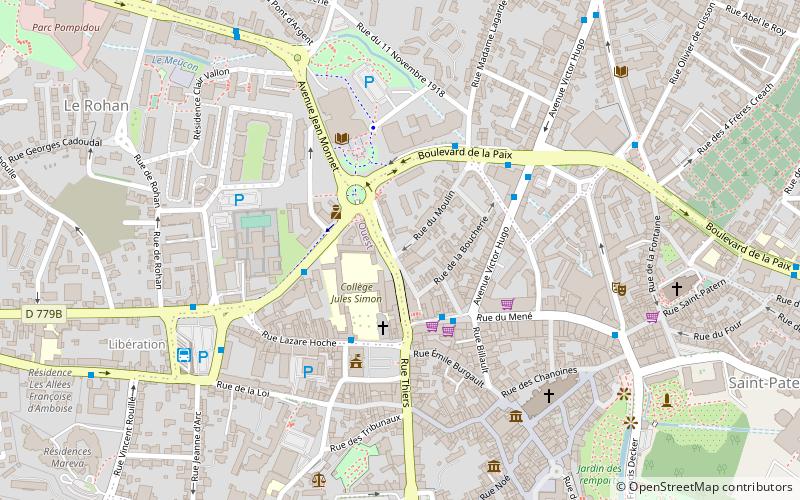
- Calculate routeLe Brix 3 min walk
- Calculate routePalais des Arts 3 min walk
- Calculate routeHôtel de Ville 3 min walk
- Calculate routeLa Paix 4 min walk
- Calculate routeVannes 13 min walk
Day trips
Golfe du Morbihan - Vannes Agglomération – popular in the area (distance from the attraction)
Nearby attractions include: Vannes Cathedral, Château-Gaillard, Église Saint-Patern de Vannes, Saint-Vincent Gate.


Frequently Asked Questions (FAQ)
Which popular attractions are close to Golfe du Morbihan - Vannes Agglomération?
Nearby attractions include Palais des arts et des congrès, Vannes (4 min walk), Hôtel de Limur, Vannes (5 min walk), Ancienne cohue, Vannes (6 min walk), Vannes Cathedral, Vannes (6 min walk).
How to get to Golfe du Morbihan - Vannes Agglomération by public transport?
The nearest stations to Golfe du Morbihan - Vannes Agglomération:
Bus
Train
Bus
- Le Brix • Lines: 1, 20, 3, 4, 5, 6a, 6b, 7, 8, D1, D3, P (3 min walk)
- Palais des Arts • Lines: 10, 11, 2, 20, D2 (3 min walk)
Train
- Vannes (13 min walk)