Trek Zone

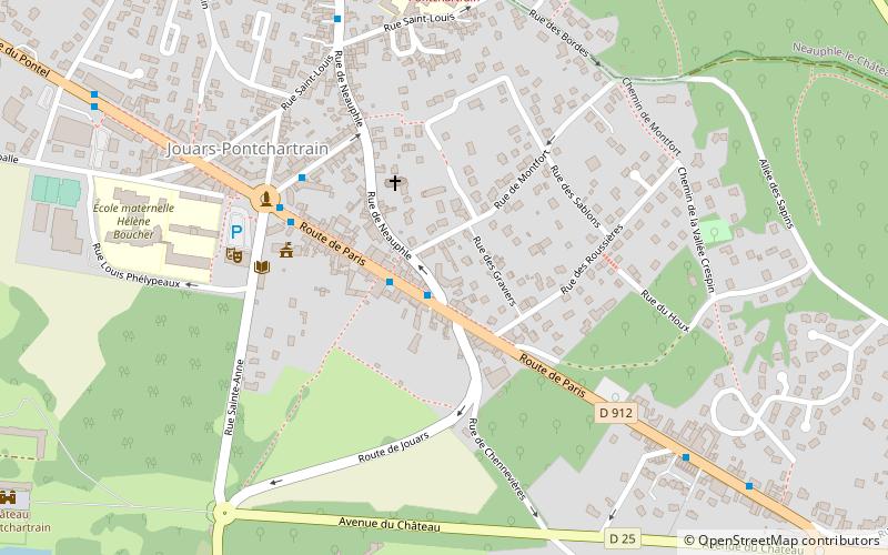
Mairie de Jouars-Pontchartrain, Jouars-Pontchartrain

#2 among attractions in Jouars-Pontchartrain

City hall
Mairie de Jouars-Pontchartrain

Facts and practical information

Mairie de Jouars-Pontchartrain (address: 1, rue Sainte-Anne) is a place located in Jouars-Pontchartrain (Île-de-France region) and belongs to the category of city hall.

It is situated at an altitude of 364 feet, and its geographical coordinates are 48°48'6"N latitude and 1°54'14"E longitude.

Among other places and attractions worth visiting in the area are: Château de Pontchartrain (forts and castles, 11 min walk), Neauphle-le-Château (locality, 22 min walk), St. Martin's Church (memorial, 23 min walk).

Coordinates: 48°48'6"N, 1°54'14"E
Address

1, rue Sainte-AnneJouars-Pontchartrain France

ContactAdd
Social media
Add

Jouars-Pontchartrain plan & book

Unleash the traveler in you — discover the cheapest flight deals, find the perfect hotel or hostel nearby, and search for the best car rental prices. Travel at your own pace to discover new places and enjoy your journey.

Day trips

Mairie de Jouars-Pontchartrain – popular in the area (distance from the attraction)

Nearby attractions include: France Miniature, Maison Louis Carré, Château de Pontchartrain, Donjon de Maurepas.

  • france miniature elancourt3.1 miSE
  • maison louis carre location map
    3.2 miSW
  • chateau de pontchartrain jouars pontchartrain0.4 miSW
  • donjon de maurepas2.2 miS
  • maurepas elancourt3.3 miSE
  • lycee les sept mares elancourt location map
    3.1 miSE
  • the jean monnet house montfort lamaury3.2 miSW
  • jardin botanique de linstitut national3.6 miNE
  • lycee jean vilar saint quentin en yvelines location map
    2.9 miNE
  • neauphle le chateau0.9 miN
  • st martins church2.5 miSW

Where to next? Visit ile de france Île-de-France region page or discover the top tourist attractions in France.