Stade André Moga, Bordeaux
Map
Facts and practical information
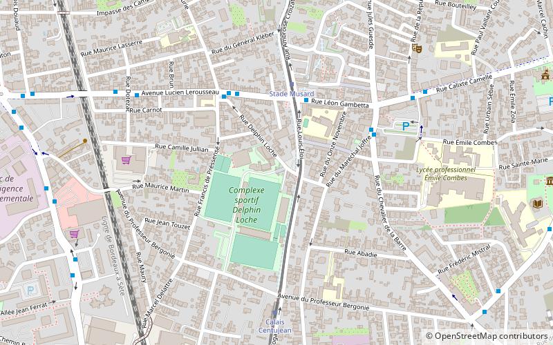
Stade André Moga is a sports stadium in Bègles, France. It hosts the home matches of Union Bordeaux Bègles, a rugby union team who play in the Top 14 competition. The Stadium is part of the Delphin Loche sporting complex which is composed of two playing fields and a Basque Pelota wall and court. ()
Address
1 Impasse Delphin LochéBègles (Centujean)Bordeaux 33130
ContactAdd
Social media
Add
Getting there by public transportation
Public transportation stops near this location
- Bus
- Tram
- Train
 Bus
Bus
- Calculate routeStade Musard 3 min walk
- Calculate routeLiberté 4 min walk
- Calculate route14 Juillet 7 min walk
- Calculate routeStade Musard 4 min walk
- Calculate routeCalais Centujean 6 min walk
- Calculate routeLa Belle Rose 10 min walk
- Calculate routeGare de Bègles 14 min walk
- Calculate routeBègles 13 min walk
Day trips


Frequently Asked Questions (FAQ)
Which popular attractions are close to Stade André Moga?
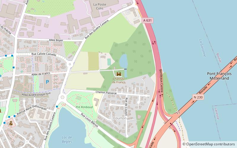
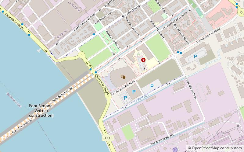
Nearby attractions include Bègles, Bordeaux (7 min walk), Musée de la Création Franche - Art brut et apparentés, Bordeaux (11 min walk), Château de Francs, Villenave-d'Ornon (22 min walk).
How to get to Stade André Moga by public transport?
The nearest stations to Stade André Moga:
Bus
Tram
Train
Bus
- Stade Musard • Lines: 43 (3 min walk)
- Liberté • Lines: 43 (4 min walk)
Tram
- Stade Musard • Lines: C (4 min walk)
- Calais Centujean • Lines: C (6 min walk)
Train
- Bègles (13 min walk)