Lac d'Aumar, Néouvielle National Nature Reserve
#2 among attractions in Néouvielle National Nature Reserve
Facts and practical information
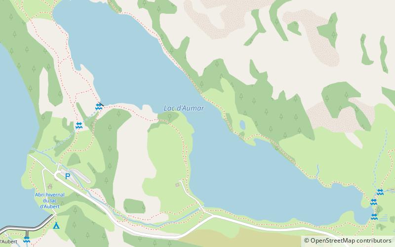
Lac d'Aumar is a lake in Hautes-Pyrénées, France. At an elevation of 2192 m, its surface area is 0.25 km². ()
Néouvielle National Nature Reserve France
Néouvielle National Nature Reserve plan & book
Unleash the traveler in you — discover the cheapest flight deals, find the perfect hotel or hostel nearby, and search for the best car rental prices. Travel at your own pace to discover new places and enjoy your journey.
Lac d'Aumar – popular in the area (distance from the attraction)
Nearby attractions include: Pic de Néouvielle, Lac de l'Oule, Lac d'Orédon, Campbieil.
- 1.8 miWSoaring peak with granite and glaciers
Pic de Néouvielle, Néouvielle National Nature Reserve
47 min walk • Pic de Néouvielle is a mountain in the Néouvielle massif in the French Pyrenees. It is located in the commune of Saint-Lary-Soulan within the department of the Hautes-Pyrénées, and lies on the border between the Pyrenees National Park and the Néouvielle National Nature Reserve.
- 2.7 miENature, Natural attraction, Lake
Lac de l'Oule
69 min walk • Lac de l'Oule is a lake in Hautes-Pyrénées, France. At an elevation of 1819 m, its surface area is 58 ha.
- 1.3 miSENature, Natural attraction, Lake
Lac d'Orédon, Aragnouet
34 min walk • Lac d'Orédon is a lake raised by a dam in Hautes-Pyrénées, France. At an elevation of 1849 m, its surface area is 0.46 km². It was one of the first lakes of the Pyrenees to have been built in the 17th century.
- 3.8 miSWNature, Natural attraction, Mountain
Campbieil, Pyrénées National Park
96 min walk • The Campbieil is a summit in the French Pyrenees, culminating at a height of 3,173 m. It is located in the Néouvielle massif, included in the Pyrenees National Park of which it constitutes the second highest summit, after the pic Long.
- 4.1 miNENature, Natural attraction, Lake
Lac de Gréziollles
106 min walk • Lac de Gréziolles is a lake in Hautes-Pyrénées, Pyrénées, France. At an elevation of 2113 m, its surface area is 0.2 km². It is accessible by the GR 10 C footpath.
- 1.7 miNNature, Natural attraction, Lake
Lac de Madamète
43 min walk • Lac de Madamète is a lake in Hautes-Pyrénées, France. At an elevation of 2299 m, its surface area is 0.026 km².
- 0.6 miWNature, Natural attraction, Lake
Lac d'Aubert, Néouvielle National Nature Reserve
16 min walk • Lac d'Aubert is a lake in Hautes-Pyrénées, France. At an elevation of 2148 m, its surface area is 0.45 km².
- 3.8 miNENature, Natural attraction, Lake
Lac du Campana
97 min walk • Lac du Campana is a lake in Hautes-Pyrénées, France. At an elevation of 2225 m, its surface area is 0.08 km².
- 2 miWNature, Natural attraction, Mountain
Trois Conseillers, Pyrénées National Park
52 min walk • The Trois Conseillers is a summit in the French Pyrenees, culminating at 3,039 metres.
- 4.4 miNBotanical garden
Jardin botanique du Tourmalet
113 min walk • The Jardin Botanique du Tourmalet is a botanical garden specializing in the flora of the Pyrenees. It is at the Pont de la Gaube on the road to the Col du Tourmalet, four kilometres from Barèges, Hautes-Pyrénées, Midi-Pyrénées, France, and open daily in the warmer months; an admission fee is charged.
- 1.6 miWScenic mountain climbing destination
Pic Ramougn, Néouvielle National Nature Reserve
41 min walk • Pic Ramougn is a steep, rocky mountain in the Néouvielle massif in the Pyrenees. It is located in the commune of Saint-Lary-Soulan within the department of the Hautes-Pyrénées, and is named after the French politician, geologist and botanist Louis Ramond de Carbonnières.