Agioi Theodoroi

Gallery (1)
Map
Map
Facts and practical information
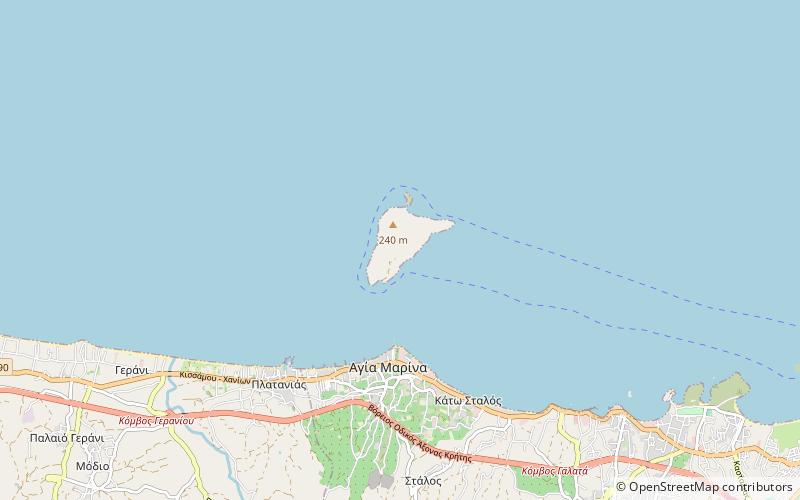
Agioi Theodoroi are two uninhabited islets off the coast of western Crete. One is named Agios Theodoros, also called Thodorou, and the islet a few metres further north is called Mikros Agios Theodoros. Administratively, they are part of the municipality of Platanias, in Chania regional unit. Kri-kri inhabit Agios Theodoros. Anciently, the islands were known as Coete or Koite and Akytos. ()
Local name: Άγιοι Θεόδωροι Αγίας Μαρίνας Χανίων Area: 0.39 mi²Maximum elevation: 541 ftArchipelago: Cretan IslandsCoordinates: 35°32'8"N, 23°55'52"E
Location
Crete
ContactAdd
Social media
Add
Day trips