Krisztinaváros, Budapest
Map

Gallery

Facts and practical information
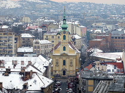
Krisztinaváros is a neighborhood in central Budapest, situated just west of Castle Hill, north of Tabán. It is named after Archduchess Maria Christina, daughter of Maria Theresa, who interceded for buildings to be erected in this area. The history of Krisztinaváros is inseparable from that of the neighboring old Tabán, Naphegy and Gellérthegy. ()
Address
Várkerület (Krisztinaváros)Budapest
ContactAdd
Social media
Add
Day trips
Krisztinaváros – popular in the area (distance from the attraction)
Nearby attractions include: Matthias Church, Buda Castle, Fisherman's Bastion, Hungarian National Gallery.
Frequently Asked Questions (FAQ)
Which popular attractions are close to Krisztinaváros?
Nearby attractions include Krisztina Téri Iskola, Budapest (5 min walk), Krisztina Tér, Budapest (5 min walk), Bastion Promenade, Budapest (7 min walk), Hospital in the Rock, Budapest (8 min walk).
How to get to Krisztinaváros by public transport?
The nearest stations to Krisztinaváros:
Bus
Tram
Train
Metro
Light rail
Trolleybus
Bus
- Ág utca • Lines: 105, 178 (3 min walk)
- Krisztina tér • Lines: 105, 16, 178, 916 (4 min walk)
Tram
- Mikó utca • Lines: 56, 56A (3 min walk)
- Krisztina tér • Lines: 56, 56A (4 min walk)
Train
- Budapest-Déli (8 min walk)
- Szent György tér (11 min walk)
Metro
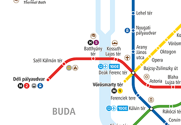
- Déli pályaudvar • Lines: M2 (10 min walk)
- Széll Kálmán tér • Lines: M2 (20 min walk)
Light rail
- Batthyány tér • Lines: H5 (22 min walk)
Trolleybus
- Kossuth Lajos tér M • Lines: 70, 78 (29 min walk)
- Báthory utca / Bajcsy-Zsilinszky út • Lines: 70, 78 (35 min walk)

 Metro
Metro


