Újpest, Budapest
Map
Facts and practical information
Újpest is the 4th District in Budapest, Hungary. It is located on the left bank of the Danube River. The name Újpest means "New Pest" because the city was formed on the border of the city of Pest, Hungary in 1838. Újpest was a village for 6 decades until 1907 when it became a town. In 1950, the town was unified with Budapest to form Greater Budapest. Since 1950, Újpest is the 4th District of Budapest. ()
Getting there by public transportation
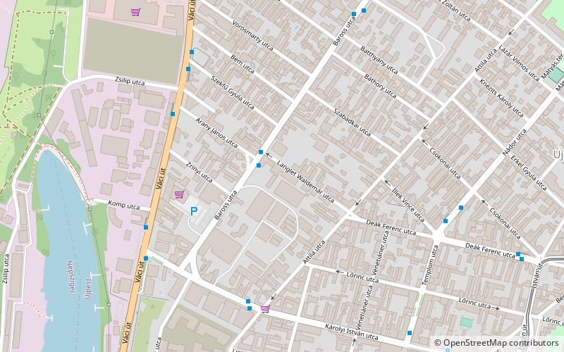
Public transportation stops near this location
- Metro
- Bus
- Tram
- Train
 Metro
Metro
- Calculate routeLanglet Waldemár utca 2 min walk
- Calculate routeZsilip utca 5 min walk
- Calculate routeAttila utca 5 min walk
- Calculate routeSzent István tér 11 min walk
- Calculate routeKiss Ernő utca 14 min walk
- Calculate routeÚjpest-központ M 14 min walk
- Calculate routeTél utca / Pozsonyi utca 20 min walk
- Calculate routeÚjpest-városkapu 14 min walk
- Calculate routeÚjpest 15 min walk
- Calculate routeAngyalföld 30 min walk
- Calculate routeIstvántelek 40 min walk
Maps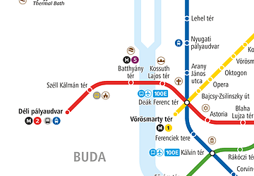 Metro
Metro
MetroDay trips


Frequently Asked Questions (FAQ)
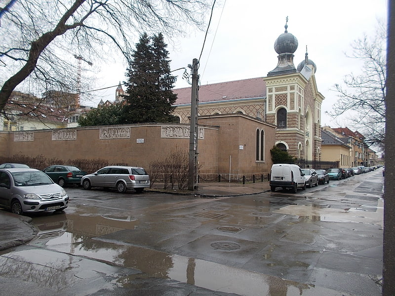
Which popular attractions are close to Újpest?
Nearby attractions include Újpest Synagogue, Budapest (14 min walk), Váci út, Budapest (15 min walk), Római Part, Budapest (23 min walk).
How to get to Újpest by public transport?
The nearest stations to Újpest:
Bus
Tram
Metro
Train
Bus
- Langlet Waldemár utca • Lines: 147 (2 min walk)
- Zsilip utca • Lines: 104, 104A, 196, 204, 300, 301, 302, 305, 306, 310, 311, 312 (5 min walk)
Tram
- Szent István tér • Lines: 12, 14 (11 min walk)
- Kiss Ernő utca • Lines: 12, 14 (14 min walk)
Metro
- Újpest-városkapu • Lines: M3 (14 min walk)
Train
- Újpest (15 min walk)
- Angyalföld (30 min walk)