Pestújhely, Budapest
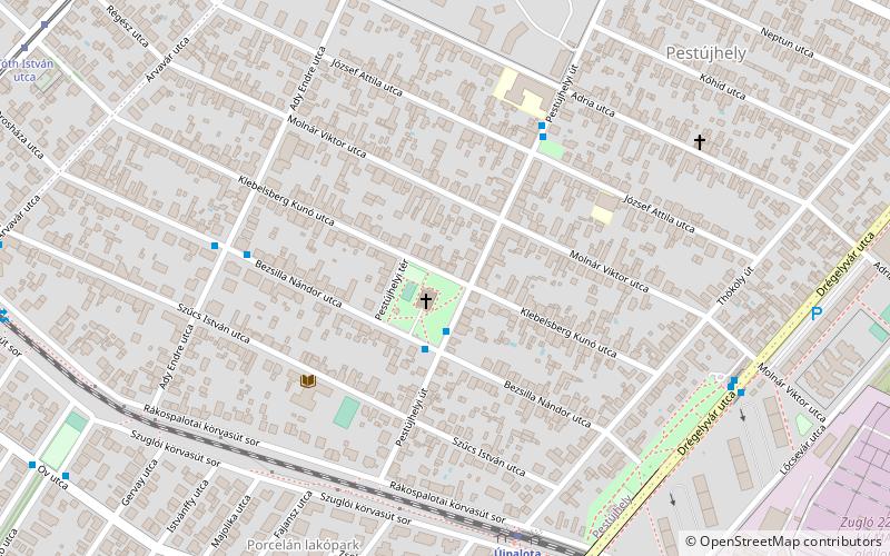
Map
Facts and practical information
Address
RákospalotaBudapest
ContactAdd
Social media
Add
Getting there by public transportation
Public transportation stops near this location
- Bus
- Trolleybus
- Tram
- Train
 Bus
Bus
- Calculate routePestújhelyi tér 2 min walk
- Calculate routeEmlék tér 5 min walk
- Calculate routeAdy Endre utca 6 min walk
- Calculate routeÚjpalota 7 min walk
- Calculate routeIstvántelek 35 min walk
- Calculate routeTóth István utca 11 min walk
- Calculate routeRákospalota, MÁV-telep 13 min walk
- Calculate routeÖv utca 15 min walk
- Calculate routeMiskolci utca 18 min walk
- Calculate routeKomócsy utca 24 min walk
- Calculate routeFűrész utca / Szugló utca 28 min walk
- Calculate routeEgressy út / Vezér utca 28 min walk
- Calculate routeErzsébet királyné útja / Róna utca 37 min walk
Maps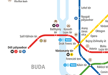 Metro
Metro
MetroDay trips


Frequently Asked Questions (FAQ)
How to get to Pestújhely by public transport?
The nearest stations to Pestújhely:
Bus
Train
Tram
Trolleybus
Bus
- Pestújhelyi tér • Lines: 124 (2 min walk)
- Emlék tér • Lines: 124 (5 min walk)
Train
- Újpalota (7 min walk)
- Istvántelek (35 min walk)
Tram
- Tóth István utca • Lines: 62, 62A, 69 (11 min walk)
- Rákospalota, MÁV-telep • Lines: 62, 62A, 69 (13 min walk)
Trolleybus
- Komócsy utca • Lines: 77, 82 (24 min walk)
- Fűrész utca / Szugló utca • Lines: 82 (28 min walk)