Üllői út, Budapest
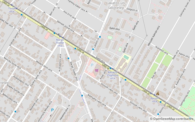
Map
Facts and practical information
Address
Pestszentlorinc-PestszentimreBudapest
ContactAdd
Social media
Add
Getting there by public transportation
Public transportation stops near this location
- Bus
- Tram
- Train
 Bus
Bus
- Calculate routeÜllői út 2 min walk
- Calculate routeLakatos út 3 min walk
- Calculate routeKemény Zsigmond utca 3 min walk
- Calculate routeMargó Tivadar utca 3 min walk
- Calculate routeKemény Zsigmond utca 3 min walk
- Calculate routeMargó Tivadar utca 5 min walk
- Calculate routeBaross utca 7 min walk
- Calculate routeTinódi utca 11 min walk
- Calculate routeKispest 17 min walk
- Calculate routePestszentlőrinc 20 min walk
Maps Metro
Metro
MetroDay trips


Frequently Asked Questions (FAQ)
How to get to Üllői út by public transport?
The nearest stations to Üllői út:
Bus
Tram
Train
Bus
- Üllői út • Lines: 36 (2 min walk)
- Lakatos út • Lines: 36 (3 min walk)
Tram
- Kemény Zsigmond utca • Lines: 50 (3 min walk)
- Margó Tivadar utca • Lines: 50 (5 min walk)
Train
- Kispest (17 min walk)
- Pestszentlőrinc (20 min walk)