Pasarét, Budapest
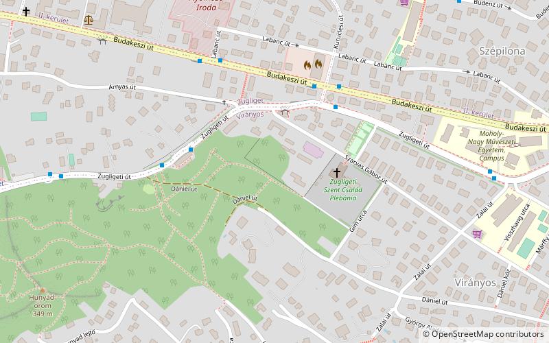
Map
Facts and practical information
Pasarét is a neighbourhood on the Buda side of Budapest. ()
Address
HegyvidékBudapest
ContactAdd
Social media
Add
Getting there by public transportation
Public transportation stops near this location
- Bus
- Tram
- Train
 Bus
Bus
- Calculate routeSzarvas Gábor út 3 min walk
- Calculate routeLóvasút 4 min walk
- Calculate routeKuruclesi út 4 min walk
- Calculate routeLabanc út 5 min walk
- Calculate routeKelemen László utca 13 min walk
- Calculate routeAkadémia 14 min walk
- Calculate routeZuhatag sor 17 min walk
- Calculate routeBudagyöngye 19 min walk
- Calculate routeNormafa 34 min walk
- Calculate routeVirágvölgy 35 min walk
Maps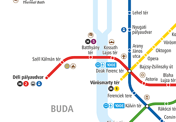 Metro
Metro
MetroDay trips


Frequently Asked Questions (FAQ)
How to get to Pasarét by public transport?
The nearest stations to Pasarét:
Bus
Tram
Train
Bus
- Szarvas Gábor út • Lines: 291 (3 min walk)
- Lóvasút • Lines: 291 (4 min walk)
Tram
- Kelemen László utca • Lines: 56, 56A, 59B, 61 (13 min walk)
- Akadémia • Lines: 56, 56A, 59B, 61 (14 min walk)
Train
- Normafa (34 min walk)
- Virágvölgy (35 min walk)