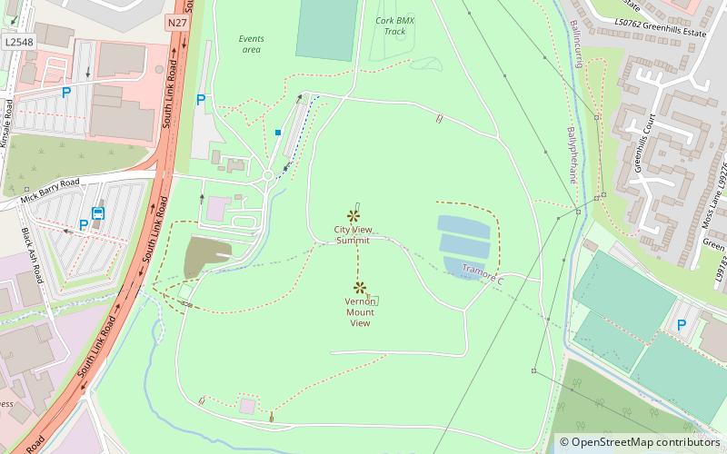
Tramore Valley Park, Cork
Map
Facts and practical information
Tramore Valley Park is a park on the southside of Cork in Ireland. With an area of approximately 160 acres, the park site is located on a landfill site which closed in 2009. While parts of the park opened in mid-2015, and had been targeted to open more completely during 2016, as of October 2018 the park had not been opened to the public on a broader scale or to larger events. The park was ultimately opened in May 2019, and is managed by the Glen Resource Centre on behalf of Cork City Council. ()
Elevation: 56 ft a.s.l.Coordinates: 51°52'41"N, 8°27'38"W
Getting there by public transportation
Public transportation stops near this location
- Bus
 Bus
Bus
- Calculate routeBlack Ash Park & Ride 7 min walk
- Calculate routeDouglas Road 220,207,216 18 min walk
Day trips


Frequently Asked Questions (FAQ)
How to get to Tramore Valley Park by public transport?
The nearest stations to Tramore Valley Park:
Bus
Bus
- Black Ash Park & Ride (7 min walk)
- Douglas Road 220,207,216 • Lines: 220/A (18 min walk)