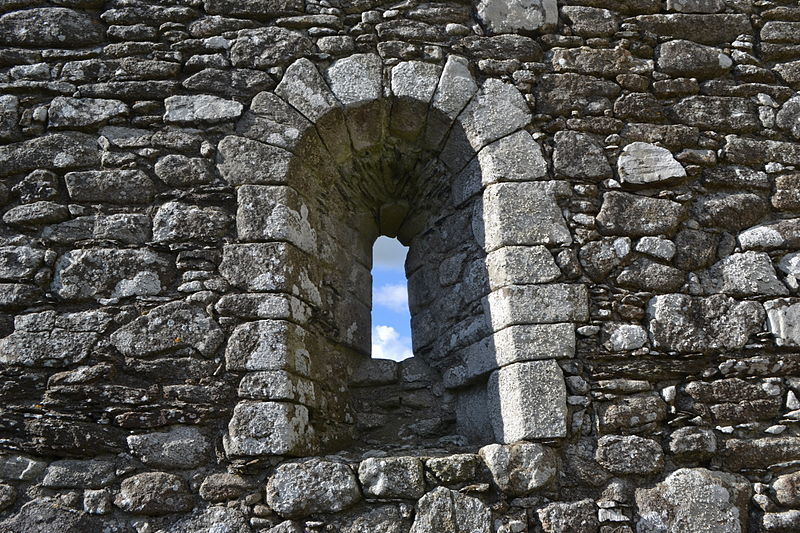
Aghowle Church

Gallery (3)
Map
Map
Gallery
Facts and practical information
Aghowle Church is a medieval church and National Monument in County Wicklow, Ireland. It was one of the largest rural parish churches of its era. Aghowle is also a civil parish in the ancient barony of Shillelagh. ()
Architectural style: Romanesque architectureCoordinates: 52°46'4"N, 6°37'14"W
Location
Carlow
ContactAdd
Social media
Add
Day trips