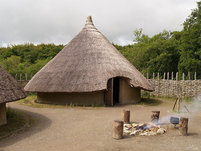
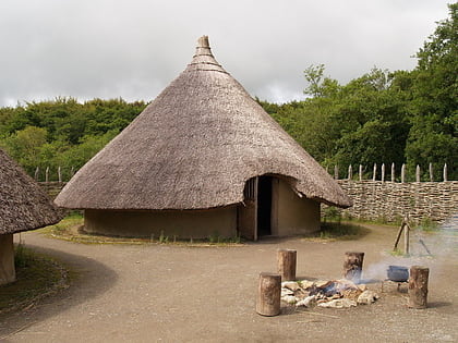
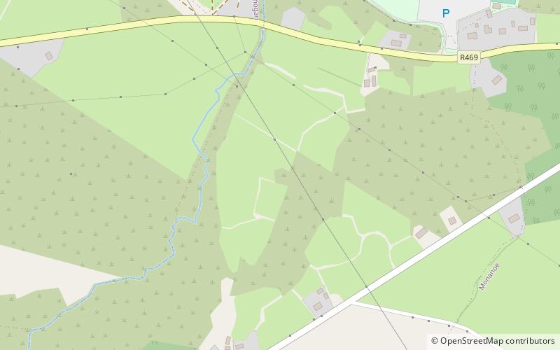
The Ringfort, Craggaunowen
#5 among attractions in Craggaunowen

Facts and practical information
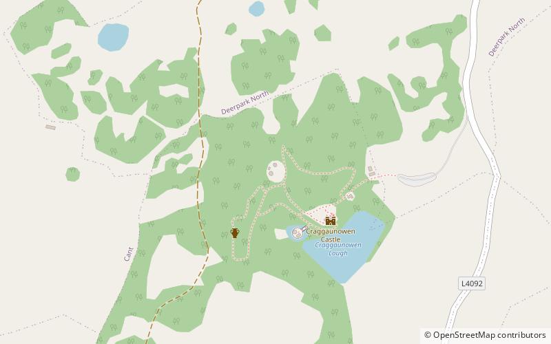
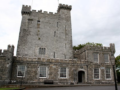
Craggaunowen is a 16th-century castle and an archaeological open-air museum in County Clare, Ireland. ()
Craggaunowen plan & book
Unleash the traveler in you — discover the cheapest flight deals, find the perfect hotel or hostel nearby, and search for the best car rental prices. Travel at your own pace to discover new places and enjoy your journey.
The Ringfort – popular in the area (distance from the attraction)
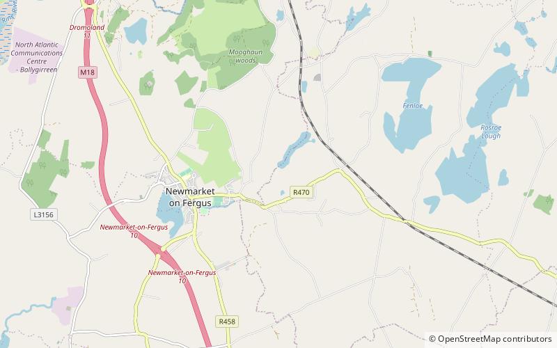
Nearby attractions include: Castle, Quin Abbey, Knappogue Castle, Mooghaun.
 History museum, Museum, Forts and castles
Castle, Craggaunowen
3 min walk • Craggaunowen is a 16th-century castle and an archaeological open-air museum in County Clare, Ireland. Craggaunowen is located 10 km east of Quin, County Clare. The name Craggaunowen derives from its Irish name Creagán Eoghain. The site is operated by Shannon Heritage.
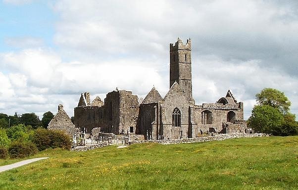
 Sacred and religious sites, Historical place, Monastery
Quin Abbey, Quin
74 min walk • Quin Abbey, in Quin, County Clare, Ireland, was built between 1402 and 1433 by Sioda Cam MacNamara, for Fathers Purcell and Mooney, friars of the Franciscan order. Although mostly roofless, the structure of the abbey is relatively well preserved.
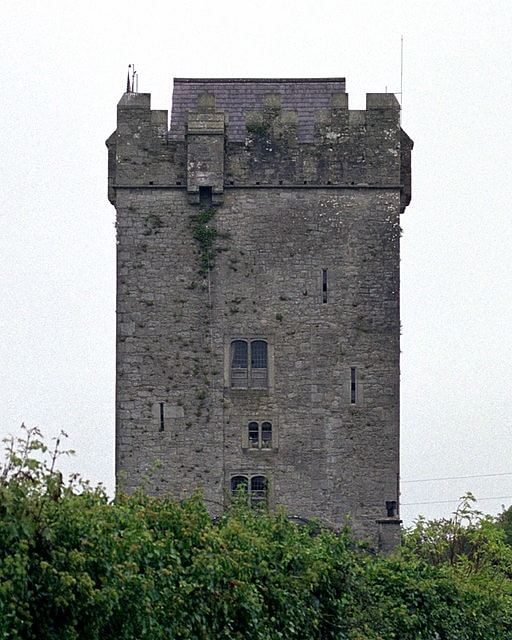
 Forts and castles, Historical place, History museum
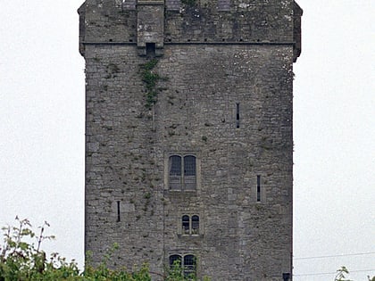
Knappogue Castle, Craggaunowen
50 min walk • Knappogue Castle is a tower house, built in 1467 and expanded in the mid-19th century, located in the parish of Quin, County Clare, Ireland. It has been restored and is open to guided tours.
 Forts and castles
Mooghaun
104 min walk • Mooghaun is a late Bronze Age hill fort located in County Clare, Ireland. It is a well preserved, recently excavated site, occupying an entire hill with wide views of the surrounding lands. Believed to be the largest hill fort in Ireland, it is one of the region's main tourist attractions.
 Equestrian trail, Horseback riding tours, Outdoor activities
Ballyhannon Castle, Quin
122 min walk • Ballyhannon Castle is a medieval Irish castle dating back to the 15th century, located near the village of Quin in County Clare, on the west coast of Ireland.
 Nature, Natural attraction, Lake
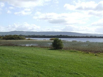
Lough Cullaunyheeda, Craggaunowen
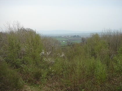
36 min walk • Lough Cullaunyheeda is a freshwater lake in the Mid-West Region of Ireland. It is located in east County Clare.
 Neighbourhood
Kilnasoolagh, Newmarket-on-Fergus
151 min walk • Kilnasoolagh is a civil parish in County Clare, Ireland, and a townland within that parish. Church records mention the parish in 1256.
 Forts and castles
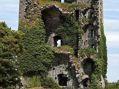
Ballymarkahan Castle, Craggaunowen
47 min walk • Ballymarkahan Castle is a ruined tower house in the parish of Quin, in County Clare, Ireland. It was listed by Irish antiquarian T. J. Westropp as one of the 195 "lesser castles", or peel towers, of County Clare in 1899, by which time it was already a ruin.
 Ruins
RuinsCarntemple
133 min walk • Carntemple, once known as Kilbrecan, is a ruined church in the civil parish of Doora, County Clare, Ireland. It may date back to 480 AD. Little remains except the massive foundations.
 Forts and castles
Ballycar Castle
120 min walk • Ballycar Castle stood in the parish of Newmarket-on-Fergus, near the road between Limerick and Galway, 3 miles from Sixmilebridge, 9 miles from Limerick, and 7 miles from Ennis it was said to have been built before 1570 and was a ruin before 1681 when it was sketched by Thomas Dineley.