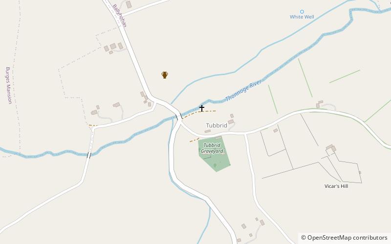
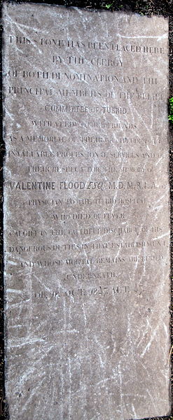
Tubrid

Gallery (2)
Map
Map
Gallery
Facts and practical information
Tubrid or Tubbrid was formerly a civil and ecclesiastical parish situated between the towns of Cahir and Clogheen in County Tipperary, Ireland. A cluster of architectural remains at the old settlement still known as Tubrid includes an ancient cemetery and two ruined churches of regional historical significance. ()
Coordinates: 52°18'54"N, 7°57'0"W
Day trips