Laraghbryan
Map
Facts and practical information
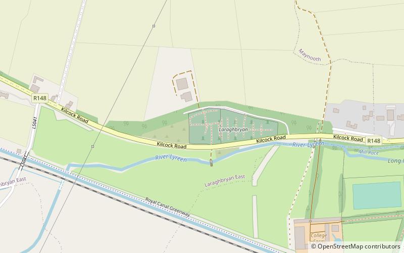
Laraghbryan is the site of an old monastic settlement, cemetery and ruined church, 1 kilometre west of Maynooth, County Kildare, Ireland. ()
Coordinates: 53°22'55"N, 6°36'49"W
Location
Kildare
ContactAdd
Social media
Add
Day trips