County Buildings, Carlow
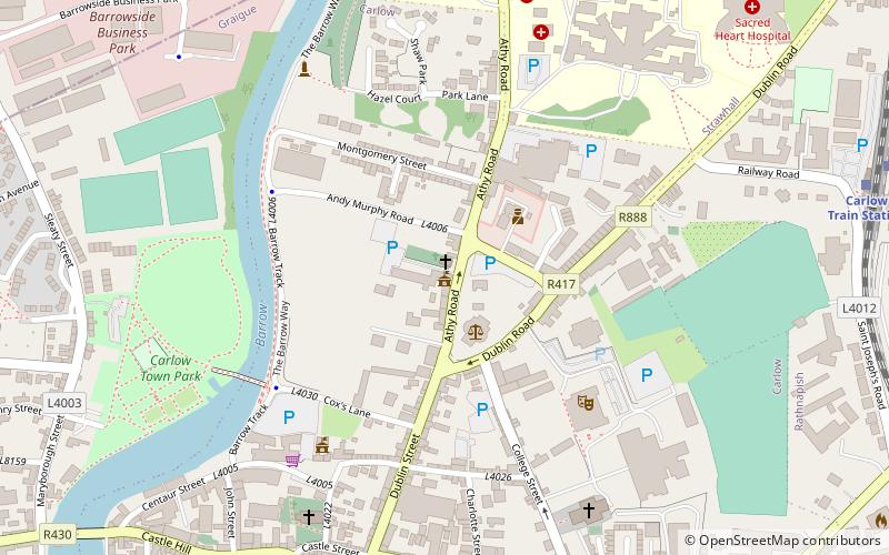
Map
Facts and practical information
The County Buildings are a municipal facility in Athy Road, Carlow, County Carlow, Ireland. ()
Coordinates: 52°50'23"N, 6°55'50"W
Address
Carlow
ContactAdd
Social media
Add
Getting there by public transportation
Public transportation stops near this location
- Bus
- Train
 Bus
Bus
- Calculate routeCarlow Train Station 9 min walk
- Calculate routeCarlow 10 min walk
- Calculate routeCarlow Early Morning 10 min walk
- Calculate routeCarlow Coach Park 12 min walk
- Calculate routeCarlow IT 18 min walk
Day trips
County Buildings – popular in the area (distance from the attraction)
Nearby attractions include: Carlow County Museum, Carlow Castle, Cathedral of the Assumption, County Carlow Military Museum.


Frequently Asked Questions (FAQ)
Which popular attractions are close to County Buildings?
Nearby attractions include St. Patrick's, Carlow (6 min walk), Cathedral of the Assumption, Carlow (6 min walk), Carlow County Museum, Carlow (7 min walk), County Carlow Military Museum, Carlow (7 min walk).
How to get to County Buildings by public transport?
The nearest stations to County Buildings:
Train
Bus
Train
- Carlow Train Station (9 min walk)
- Carlow (10 min walk)
Bus
- Carlow Early Morning • Lines: Tramore - Waterford - Dublin Air (10 min walk)
- Carlow Coach Park • Lines: Dublin Airport - Waterford - Tra, Tramore - Waterford - Dublin Air (12 min walk)