Fort Haldane
Map

Map

Facts and practical information
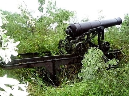
Fort Haldane is located near Port Maria in the parish of St Mary, Jamaica and was erected in 1759. It was named after General George Haldane, then Governor of Jamaica. The fort was constructed to protect the harbour of Port Maria from Spanish raids. It was also used as a garrison to keep the enslaved and working classes of St. Mary under control. ()
Built: 1759 (267 years ago)Coordinates: 18°22'60"N, 76°54'0"W
Location
Saint Mary
ContactAdd
Social media
Add
Day trips
Fort Haldane – popular in the area (distance from the attraction)
Nearby attractions include: Firefly Estate, Oracabessa Bay Fish Sanctuary, James Bond Beach, Galina Lighthouse.


