Fort George
Map

Map

Facts and practical information
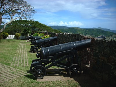
Fort George is situated on the Titchfield Peninsula in the town of Port Antonio, in the parish of Portland, Jamaica. The proposal for a fort in Port Antonio was first discussed in 1728, when a committee of the House of Assembly met to consider measures to be taken in the face of a possible Spanish invasion. In 1729, Christian Lilly was assigned the task of building a fort which, after being built, became known as Fort George in honour of King George I of Great Britain. Lilly had built some of the walls at the Royal Citadel, Plymouth, and the bastion at Fort George was designed as a smaller version of the Citadel. ()
Location
Saint Mary
ContactAdd
Social media
Add
