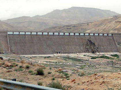
Mujib Dam
Map

Map

Facts and practical information
Mujib Dam is located in Wadi Mujib, between the cities of Madaba and Kerak, in the Madaba Governorate of Jordan. It is a rolled concrete dam with abutments of clay-core rockfill completed in 2004, after six years of construction. Highway 35, part of the historic King's Highway, crosses the crest. The water it impounds is combined with desalinated water piped from brackish wells along the Dead Sea to the west in a reservoir holding 35 million m3 which primarily supplies Amman, 100 kilometres to the north helping to ease a very stressed national water supply. ()
Local name: سد وادي الموجب Opened: 2004 (22 years ago)Length: 2507 ftHeight: 220 ftCoordinates: 31°26'41"N, 35°49'4"E
Location
Karak
ContactAdd
Social media
Add
Day trips
Mujib Dam – popular in the area (distance from the attraction)
Nearby attractions include: Dhiban.

