Phou Xang He National Protected Area

Facts and practical information
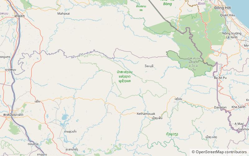
Phou Xang He National Protected Area is a national protected area in Savannakhet Province in central Laos. This mostly pristine forested park is home to a large variety of important animal and bird species. The park is home to the Phu Tai and Katang ethnic groups and is an ecotourism destination. ()
Savannakhét
Best Ways to Experience the Park
Wildlife
AnimalsSee what popular animal species you can meet in this location.
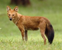
Asiatic Wild Dog, Red Dog, Dhole
The dhole, also known as the Asian wild dog, Asiatic wild dog, Indian wild dog, whistling dog, red dog, or mountain wolf, is a captivating canid indigenous to Central, South, East, and Southeast Asia. Although closely related to species in the Canis genus, dholes...
Mammals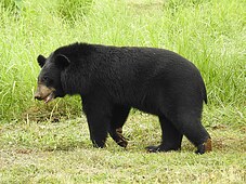
Asiatic Black Bear
The Asian black bear, also known as the Asiatic black bear, moon bear, and white-chested bear, is a captivating medium-sized bear species native to Asia. These bears are highly adapted to an arboreal lifestyle, spending substantial time in trees.
Mammals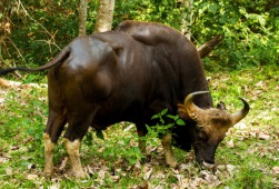
Gaur
The gaur, also known as the Indian bison, is a massive and impressive wild cattle species native to South and Southeast Asia. Unfortunately, it has been listed as Vulnerable on the IUCN Red List since 1986, with an estimated global population of up to 21,000 mature...
Mammals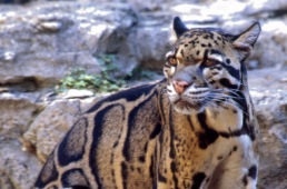
Clouded leopard
The clouded leopard is a captivating medium-sized wild cat inhabiting the Himalayan foothills, Southeast Asia, and southern China. Since 2008, it has been classified as Vulnerable on the IUCN Red List. With fewer than 10,000 mature individuals remaining and no single...
Mammals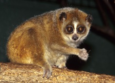
Lesser Slow Loris
The pygmy slow loris is a fascinating small creature native to Vietnam, Laos, Cambodia, and China. This nocturnal, arboreal animal prefers a variety of forest types and typically lives in small family groups. Its diet includes fruits, insects, and tree sap.
Mammals