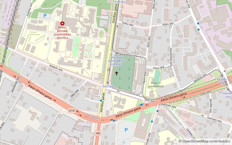
Zemgale Suburb, Riga

Map
Facts and practical information
Address
Zemgales (Bieriņi)Riga
ContactAdd
Social media
Add
Getting there by public transportation
Public transportation stops near this location
- Bus
- Trolleybus
- Tram
- Train
 Bus
Bus
- Calculate routeMežotnes iela 2 min walk
- Calculate routeĢimnastikas iela 9 min walk
- Calculate routeAsītes iela 9 min walk
- Calculate routeAtgāzene 15 min walk
- Calculate routeBiznesa augstskola Turība 20 min walk
- Calculate routeTorņakalns 32 min walk
- Calculate routePaula Stradiņa slimnīca 21 min walk
- Calculate routeRobežu iela/Bērnu slimnīca 22 min walk
- Calculate routeĢimnastikas iela 22 min walk
- Calculate routeTukuma iela 23 min walk
- Calculate routeTelts iela 22 min walk
- Calculate routeVienības gatve/Bērnu slimnīca 23 min walk
- Calculate routeJelgavas iela 24 min walk
Day trips
Zemgale Suburb – popular in the area (distance from the attraction)
Nearby attractions include: Monument to the Liberators of Soviet Latvia and Riga from the German Fascist Invaders, Church of Luther, Āgenskalns Market, Turība University.


Frequently Asked Questions (FAQ)
Which popular attractions are close to Zemgale Suburb?
Nearby attractions include Bieriņi, Riga (8 min walk), St. Albert's Church, Riga (18 min walk), Peitav Synagogue, Riga (18 min walk), Atgāzene, Riga (19 min walk).
How to get to Zemgale Suburb by public transport?
The nearest stations to Zemgale Suburb:
Bus
Train
Trolleybus
Tram
Bus
- Mežotnes iela • Lines: 55 (2 min walk)
- Ģimnastikas iela • Lines: 10, 25, 55, 56 (9 min walk)
Train
- Atgāzene (15 min walk)
- Biznesa augstskola Turība (20 min walk)
Trolleybus
- Paula Stradiņa slimnīca • Lines: 5 (21 min walk)
- Robežu iela/Bērnu slimnīca • Lines: 27 (22 min walk)
Tram
- Telts iela • Lines: 10 (22 min walk)
- Vienības gatve/Bērnu slimnīca • Lines: 10 (23 min walk)